Tag: waves

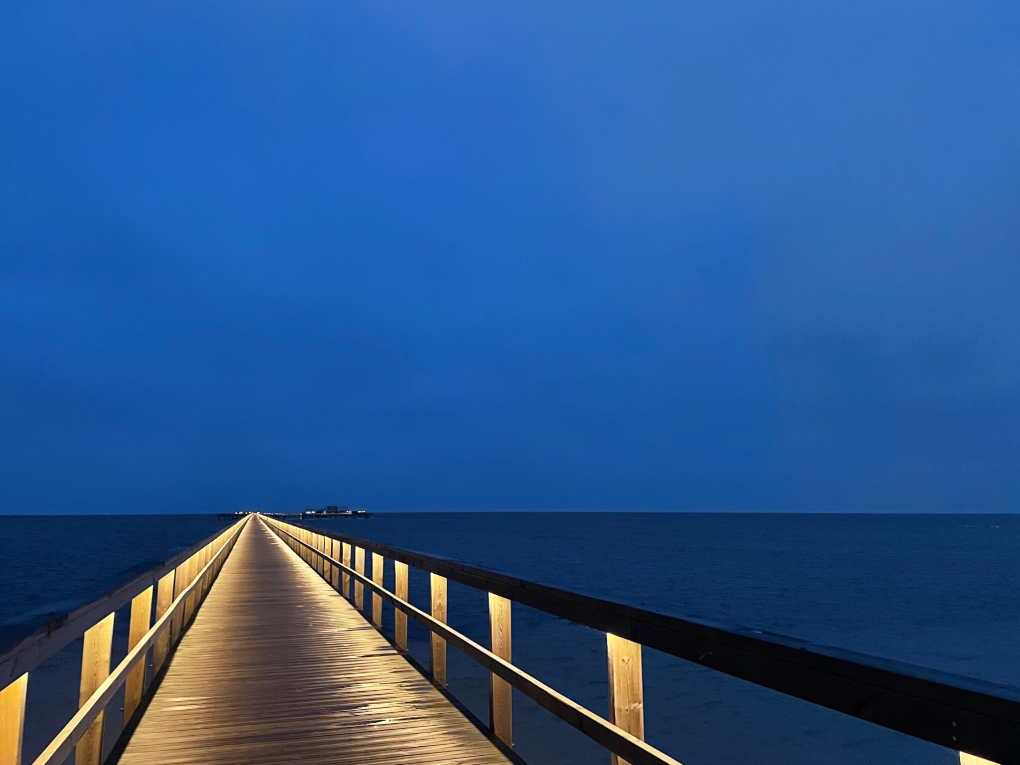
Irregular wave ripples, and some left on the beach when the water is gone
I’m getting more and more fascinated with wave ripples. I kinda understand how they form, but not enough to be able to explain as much about them as I would…
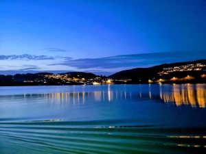
Reflections in waves
After doing a #friendlywaves post from a Norwegian fjord yesterday, let’s do another one from somewhere south of Bergen, by my friend Arnt. Very different mood today! What I find…
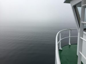
A #friendlywaves from a field trip in a Norwegian fjord
The other day, my friend and co-author Pierré sent me pictures he took during fieldwork in a Norwegian fjord. As I, sadly, wasn’t there, all I can do now is…

Visiting my friend’s office for some #wavewatching
Since we seem to be on the topic of wake watching these days, here are some pictures I took when visiting my friend Liz at the European Cruise Service’s offices…

I’m explaining your wave pictures: A #friendlywave from the Île d’Yeu, France
The whole #friendlywave thing (where I explain your wave picture) is starting off great! Here is one that reached my via my Twitter; link to thread here. What’s going on…
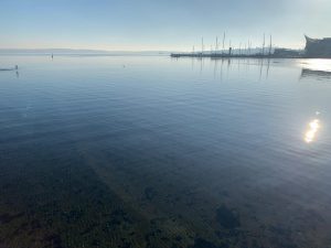
Commissioned wave watching: Eckernförde edition on a beautiful calm and sunny Sunday!
Recently, more and more of my friends send me pictures of waves they spotted when walking along a lake side or taking a ferry ride. I love how contagious wave watching…
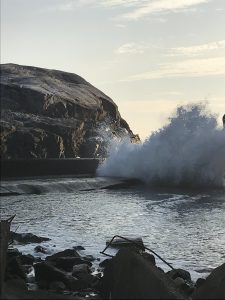
Visiting the ruins of a wave power plant — waves running up a funnel to fill a reservoir
Using wave energy to generate electricity sounds very attractive, after all there are tons of waves and all they do (in addition to looking pretty) is eroding coast lines. But…
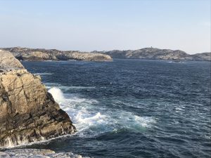
Visiting the ruins of a wave power plant — waves driving a turbine
After posting about how longer fetch leads to higher waves yesterday, here is why I was in that exact spot in the first place: To visit an old wave power…
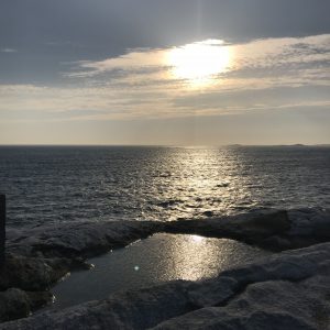
Same wind, different waves, or: the influence of fetch length on the size of waves
I just found this picture that I took back in May near my friend Elin’s cabin on an island in western Norway, and it’s a really nice illustration of how…

Observing waves in a tank
So you thought filling water into a tank was boring? Not on my watch! This is how we fill up the tank: Through a hole at the bottom. Which leads…

Mystery picture! Can you solve this wave riddle?
Today is a great day for a wave riddle! Below you see a picture I took on my walk home the other day. Can you tell what caused those waves? (Solution…

Why are they so much slower than I thought? Observing the group velocity vs phase velocity of waves
Have you ever seen a speedboat drive past, looked at its wake moving torwards you, then gotten distracted, and when you look back a little while later been surprised that…

Thinking about the Doppler effect as of a boat sailing against the waves!
I can’t believe I haven’t written about this on my blog before, thanks Markus Pössel for reminding me of this great way to understand the Doppler effect! Doppler effect, or…

Wave reflections
This still is one of my favourite kinds of wave field to look at. So calming. (Who am I kidding. All waves are my favourite waves, of course! I am…
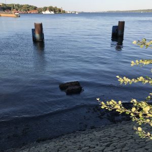
Wave watching: Refraction and diffraction of waves
A little more wave watching, today with a focus on how waves change direction when they run into shallow water. Let’s look at this beautiful wave and see what happens when…

Wave watching at the Kiel Holtenau locks
So many people are surprised when I speak of wave watching as of a “real activity”. But to me it is! So I am going to talk you through a…

When not the fetch but a funnel shapes the wave field
As you know we are currently preparing for future wave riddles. So this afternoon I went out for a wave hunt again and found something beautiful for you! The ship…

What makes and destroys waves
Today I have a couple of photos for you to prepare you for upcoming wave riddles. Since, in those riddles, I usually ask what might have caused the wave on…

Waves in a density stratification. One of the most beautiful tank experiments I’ve ever seen.
It’s pretty impressive when a mountain moves through a stratification and generates lee waves. But what I find even more impressive: The waves that travel behind the mountain when the…

Wave watching Sunday in Grenoble
Today I went on a wave-hunt expedition to take pictures for posts on the Froude and Reynolds number over at Elin & team’s blog (which you should totally check out if…

Total reflection and fishies
Do you know the phenomenon that once you start noticing something, you see it everywhere? That’s been the case with me and total internal reflection. Not quite as impressive as…

Total internal reflection
Have you ever wondered why at some angles the sea looks blue (or whatever the color of the sky that day) and at others you can actually look into the water?…


Amplification of waves when they run into shallower water
It’s one thing to know that waves build up as they run from the open ocean over the shelf onto a beach, and that they build up as the water…


Awesome interference pattern in a Norwegian fjord
“Hei Mirjam. Bergen had it’s two days of allocated summer during the weekend of 22 – 23 July 2017 and Elsa and I decided to – in true Norwegian style…

Best investment into my mental health?
Joining a local club that gives me access to this whenever I like…

Feathery wavelets and wakes
My sister took this amazing picture — and from a train no less! And I got super excited. Can you see the feathery wavelets* of the bow wave of that large…

More than 2/3rds need to be water
I’m in this weird phase right now: In landscape pictures that I take, I like more than 2/3rds of the total area to be of water. That I like water…

Tiny islands, shelter from the storm and the wings of the morning
If I take the wings of the morning, and dwell in the uttermost parts of the sea…
Expedition learning
Last week, we ran an “expedition learning” course for 17-year olds. They were separated into several groups, working on different topics, and mine (unsurprisingly) worked on waves. You can see…

Weekend wave-watching
Of course I did not only take pictures of lighthouses and instructional activities during the teacher training at Lotseninsel last week. I also took TONS of pictures of water! Some…

Wave watching
This is an old picture from early spring, but I just love how the reflection of that pier shows up the different wave lengths so clearly. The longer swell wouldn’t…
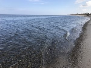
Refraction of waves towards the beach
As you see from my parents’ attire and the lack of leaves on the trees, these pictures are not brand new. But still interesting: Do you see how the waves…
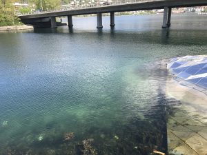
Diffraction of waves around obstacle
I have always really liked the artwork you see below that was installed in Store Lungegårdsvann when I still lived in Bergen. But on the pictures here you also see how…


Shallow water waves
Have you ever noticed how, if you are at a shallow beach, no matter how choppy waves are further offshore, everything becomes nice and orderly on the beach? Below you…

Duckies, a drama and a wake
Let me tell you the story of the picture below. I was walking along Kiel fjord with some friends and we saw this mama duck with all those tiny cute…

Reflected wakes
When a ship has sailed past, at first you see only its wake. And then you see reflected bow waves interfering with the original wave pattern: See?
Diffraction
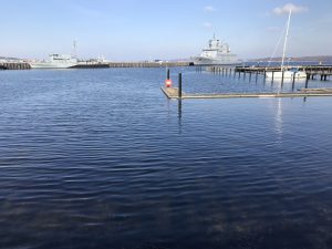
I find it really fascinating to watch waves being bent by objects in their way. See how the wave is spreading out from the little slit? Or here how waves…

Surfactants
When I was talking about foam stripes the other day, you might have noticed that the foam stripe wasn’t a foam stripe all the way, but became “just a stripe”.…

Waves reflecting on a sea wall
I really like it when waves reach a sea wall at an angle, because the resulting criss-cross looks so cool :-) And especially cool when you see it gradually building…

Foam stripes
One sunny morning, I noticed The Stripe again: Running all the way up and down the coast. In places where there is a large fetch the stripe is clearly foamy:…

Standing waves in a current
The other day I found the perfect standing waves on a current: This egg-carton-like pattern really stays pretty constant over time and I think the changes in the wave pattern…

Expedition learning
In July I will be involved in teaching an “expedition learning” course for a week. It will be all about coastal protection in the Kiel region, so two colleagues and…

Wakes of ducks
I really like observing the wakes of ducks. Much easier to watch than those of ships because the scale is much more person-standing-on-the-sea-wall friendly. Also much less turbulence messing up the…

Group velocity and phase velocity
When I recently wrote about observing waves in a different way, I talked about light being focussed by the waves on the sea floor. In the other post, I focussed…

Observing waves differently
When we speak about “observing waves”, we usually mean looking at the water’s surface as an opaque surface that reflects the sky and where we see waves mainly due to…

Playing with a thermal imaging camera
I recently borrowed a thermal imaging camera from work. So much fun! Below you see a cold sky, warmer trees and two really warm people walking through the park. One…

More funny waves
I think I might need to find a new route to walk along the Kiel fjord. When I was walking — in the most beautiful sunshine! — with my friend…

Nonlinear effects in shallow water waves
I recently googled for something related to the shape of waves and came across a photo of a wave that caught my eye, and it took me to a journey that…

Funny waves on Kiel fjord
The other day I noticed a funny wave pattern on Kiel fjord. Unfortunately I only took a picture where you see what caused the wave pattern: A step that was…

Foam stripes mystery — closer to figuring out what’s going on?
I think I might be getting closer to understanding the foam stripe mystery. Remember how we’ve always observed them going in parallel to the coast? Yesterday I saw this again,…

Foam stripes again…
…because they follow the coastline so nicely and I still don’t understand what’s going on there…

Ice and waves
Waves going through very fresh, still flexible ice. What an exciting topic :-) We had a first look at the picture below in the last blog post already, when we…

Ice forming on Kiel fjord
One thing I really like is watching ice form. Well, maybe not watching the actual freezing (don’t have the attention span for that) but looking at all the different stages.…

Shelter from the storm
Shelter from the storm, no, shelter from the breeze. But we clearly see the sheltering effect of that boat shed on the wind waves… Same thing below. And wasn’t that…

Wind waves
No matter how often I’ve seen it, I still find it absolutely fascinating how the tiniest structures can have a really visible effect on the downwind wave field. Like for…

Interference of one wave field with its reflection and a second wave field
All you regular readers of my book and my blog surely recognize what’s going on below? Yes! A wave field comes in at an angle to the pier and gets…

Wave-watching
Do you know the feeling when you, even on the most beautiful of days, want to get out of the pretty parks as quickly as possible so you can finally…

Wavelength dependency of wave-object-interactions
Wavelength dependency of wave-object-interactions. What a title! :-) But that is exactly what I observed over the enormous timespan of three full minutes (as shown by the time stamps of…

Surface films dampen waves
On Tuesday I talked about sea weed accumulating close to the sea wall in Kiel fjord, and I showed you the picture below. One thing that I found really interesting…

Foam stripes parallel to the coast, take 2
I recently got a new comment on my blog post on foam stripes parallel to the coast, and since you guys hardly ever comment on my blog (I like getting…

Swell and wind waves
Sometimes waves are very regular and mostly of the same length. Those are the ones that I usually talk about when I talk about interference of waves. But of course,…

Watch the dispersion relation in action
Remember how we talked about how waves seem to propagate extremely slowly into that calm patch that occurs when a boat pulls away from a dock? Well, the other day…

Awesome wake of high speed catamaran
This post has been in the making for a very very long time. I have now decided to stop overthinking and just share the movie with you, because who wouldn’t…

Waves transport energy, but not mass
Usually we see wave crests propagating, and since the eye can’t stop following them, it is easy to assume that they transport water with them instead of leaving the water…

Waves break when they reach a critical steepness
You can quite accurately predict when a wave is going to break. When it will break depends on its steepness, which depends on the slope that it is running up…

Waves change their direction because of changes in water depth
When waves run up a beach, they change their direction because for shallow water waves, phase speed depends on water depth (see this post for a nice little visualization for…

How water changes coast lines
One thing I have been noticing a lot recently is how water changes coastlines (or even just paths in parks). Not really surprising, considering the enormous amounts of energy stored…

The enormity of waves
It’s easy to forget the enormous size and power associated with waves in the ocean. Yes, we see pictures of surfers on Hawaii or of ships in waves occasionally, but usually…

Waves in the clouds
On my way back from London I had an almost equally interesting flight as on my way to London, which I talked about here and here. Except that most of…

Another wave hunt expedition: Learning to discover ocean physics wherever you go
One of my favourite topics right now: Learning to “see” ocean physics wherever you go. For example here: A visit to my goddaughter in Schleswig, and this time we are practicing all…

Why waves propagate so slowly into smooth patches of water
The morning I went to Heligoland I spent some time in the port of Hamburg, trying to film a phenomenon I had recently chatted about with the author of this inspiring guest…

Foam stripes parallel to the coast.
On my way to Heligoland the other day I noticed a phenomenon that I found really intriguing and that I should probably be able to explain. I first saw it on…

A touristy post about my trip to Heligoland
I recently went on a trip to Heligoland, Germany’s only island that is far away from the mainland (70 km in this case). It was a great trip, and I…

Looking at how waves are bent
As soon as waves run into water that becomes shallow enough for the wave to “feel” it, the waves start changing how fast they propagate. And depending on the shape…

More wave-spotting in “urban environments”
I recently started looking at waves in “urban environments” (in contrast to “on the sea”) with a new found fascination. The reason why will be revealed soon, but for now…
Walking around a lake to look at waves from all sides
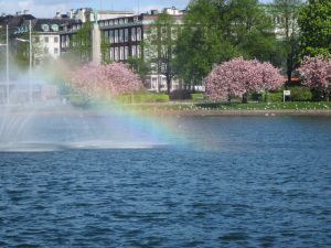
The most awesome thing about being on vacation is that I have the time to stare at water as much as I like. For example the other day, I walked…
Diffraction and reflection of waves
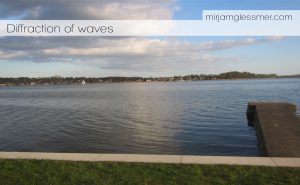
Last night, we saw really nice wave phenomena on the Schlei in Schleswig. Do you see the waves being diffracted by the pier in the picture below? Waves are coming in…

Foam stripes on the water.
Sometimes you need to look at the bigger picture to understand what is going on, especially when looking at phenomena on the water. My dad recently sent me the images…

Rain on water — why does each raindrop cause several concentric waves?
When we watch rain falling on a water surface, we observe that each raindrop causes several concentric waves with different radii. In my post on Tuesday I just stated that that was what we observe,…

If waves spread equally in all directions, then how come we see linear wakes?
If waves spread equally in each direction along the water’s surface, then how come ships (or ducks) have wakes that are just those long lines of waves and not circular at…
More wave phenomena on a lake, and a bit about wind
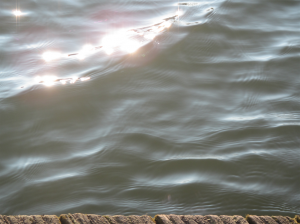
Last week I showed you the results of my “wave hunt expedition” on Aasee in Münster. Today, I am following up with the same lake on the day after and…

Submerged hydraulic jump – observing hydrodynamic phenomena in real life
Hydraulic jumps, especially submerged ones, are a very theoretical concept for many students, one that occurs in a lab experiment if they are lucky, but more likely only seems to…

Amplifying waves
A pier full of sail boats, perpendicular to the prevailing wave direction, and voila: Instant demonstration of an amplified wave! Look at how the masts show a transversal wave: Maybe…

Waves on a slope
Earlier this year at Forscherfreizeit Ratzeburg – the summer camp at which Conny, Siska, Martin, a bunch of teenagers and myself spent a week sailing, exploring and playing with water –…

Interference of waves
The advantage of wind-less days on a sailing holiday is that you can play with water as much as you like. For example in order to look at the interference…

Cloud waves – wave clouds
Another one of those days where I kinda wish I had taken at least some meteorology at some point (only “kind of” because I wouldn’t want to miss any of…

Weird algae stripes
The other day I was waiting for my friend and her daughter and noticed a weird stripe-y pattern in the distribution of algae. As I kept watching, the pattern started…

Refraction of waves
I remember being on a looooong walk on some Danish dike when my sister was small and really didn’t want to walk any more, telling her about how phase velocity of…

Waves radiating from an object
In the last post, I showed you flow separation on a pylon in Elbe river. Remember? Today, we are back at the same pylon, only that this time the tidal…

Waves on a current
When you throw a stick in the water and the waves don’t form circles. Throwing something in the water usually results in waves traveling out in circles from the point…

Drops and a pool
Sometimes I am so glad to have this blog, just because it gives me permission to do things like film drops falling from a wet life vest into a pool…
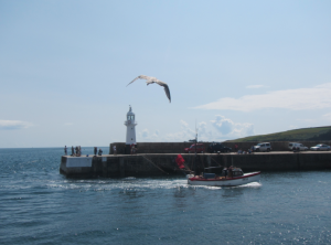
How the shape of your bow can save you a lot of time and money
My dear ship builder and naval architect friends, if this post seems horribly oversimplified to you, you are very welcome to write a guest post and go into this topic…

Wave fields around objects in a channel
One of the reasons I have been wanting to do the vortex street experiment I wrote about on Monday is that it is pretty difficult to visualize flow fields (especially if…
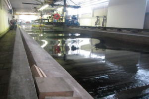
Stokes drift
When a higher-order effect suddenly becomes important. During our excursion to Hamburg Ship Model Basin (HSVA), one of the experiments we ran was on Stokes drift. You can already see in that post’s…

Wave tank
Excursion to Hamburg Ship Model Basin. I recently got to join a class on their excursion to Hamburg Ship Model Basin (HSVA, “Hamburgische Schiffbau-Versuchsanstalt” klingt so viel besser!). Those are amazing facilities…

Tides in a glass
A very simple experiment to show how waves can travel around an ocean basin. I wrote these instructions for a book project that I was lucky enough to get involved…

More interference of waves, this time as seen “at sea”
“At sea” in quotes, because technically we were at the mouth of the Weser river… But still! (deutscher Text unten) The really exciting thing working with the kids here at…

Wave interference in a tank
Creating waves and watching them interfere. (deutscher Text unten) You might not have guessed it from reading about our waves meeting over a sandbank experiment, but we weren’t doing in…

Waves and sandbanks
Creating waves in a tank. (deutscher Text unten) In the big tank, we have a paddle that is really good for making big waves. And if you create them in just…

Hair-dryer driven surface waves
Looking at wave length, frequency and speed. (deutscher Text unten) The wave group played with a tank and a hair dryer (the hair dryer safely away from the water, obviously) and…

Standing waves
Standing waves caused by rocks in a current. I am incredibly fascinated by standing waves. The standing waves are caused by rocks sitting in a current. From the pictures below…

Reading the water
Just because it’s fun! :-) I’ve mentioned before that I tend to stare at water when nobody else seems to find anything interesting to look at. So just because I’m…

Wind waves meet current
Wind waves on one side of the current – no waves on the other. Recently in Bergen, I was walking to meet up with a friend at the kayak club,…

Rogue waves in a bath tub
Trying to create rogue waves in the bath tub of the infamous “red house”. As a part of their projects, students in the CMM31 in Isafjördur course had to conduct…

Ship-generated internal waves
A tank experiment showing ship-generated internal waves. When entering a fjord from the open ocean by ship, it can sometimes be noted that the speed of the ship changes even…

Langmuir circulation, take 2
Attempt at mechanistic understanding of Langmuir circulation. After complaining about how I didn’t have mechanistic understanding of Langmuir circulation recently, and how I was too lazy to do a real literature…

Velocity of shallow water waves.
The experiment we run to discuss the velocity of shallow water waves. In this post, I discussed how it took us several years to modify an experiment to make it…

Seesawing of standing waves.
Improving one of the experiments run in the GEOF130 lab. One experiment that has been run in GEOF130 forever is the “standing wave”, where a wave is excited in a…

Waves being deflected towards regions of lower phase velocity
Movie of waves being deflected towards regions of lower phase velocity. We are so used to seeing waves behave in a certain way that we usually don’t stop and think…

Types of breaking waves depending on steepness of slope – small scale
Video of different types of breakers – small scale. In this recent post we talked about types of breakers depending on the steepness of the slope. But even on a…

Waves breaking depending on steepness of the slope
Waves breaking on slopes of different steepnesses. Depending on a slope’s steepness, waves can break in very different ways. On nearly horizontal beaches, spilling breakers develop. On steeper beaches, plunging…

Interference of waves.
Movie on wave interference – two wave fields arriving perpendicular to each other, interacting and leaving. When talking about waves, it is often difficult to explain that wave heights of…

Standing waves.
A seesaw to visualize how standing waves move in an enclosed basin. In enclosed basins, standing waves can occur. In the simplest case, they have a node in the middle…

Progressive waves on a rope
Visualization of progressive waves: wave form and energy move forward while the rope itself stays in place. When I talked about waves in GEOF130 recently, in order to explain the…

Internal waves in the atmosphere
A photo of internal waves in the atmosphere. Internal waves exist on the interface between fluids of different densities. In the ocean they are mostly observed through their surface imprint.…

Details of lee waves in the tank.
A movie focusing on details of the lee waves in the tank. In this post, we investigated lee waves in a tank in a general way. Here, I want to…

Surface imprints of internal waves
How internal waves in the ocean can be spotted on the surface. Under certain conditions, internal waves in the ocean can be spotted at the ocean’s surface due to changes…

Internal (lee) waves in a tank.
Lee wave experiment in a large tank with a moving mountain. In this previous post, we talked about internal waves in a very simple experiment. But Geophysical Institute has a great…

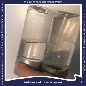
Internal waves in a bottle
Internal waves are shown in simple 0.5l bottles. Waves travel on the interface between fluids of different densities and the phase speed of those waves depends on the density difference…

A fetching title for a fetching photo post
Using a photo from one of my research cruises to explain the formation of wind waves. Wind waves are (surprise coming up!) waves generated by wind that blows over the…