Category Archives: #friendlywaves

A #friendlywaves from Tampa, Florida

Anyone who might be new to my blog because of yesterday’s presentation at #SiPManc — please don’t be scared and run away, this is the most complicated #friendlywaves I have ever gotten, usually things are A LOT easier! :-)

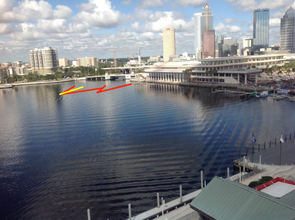
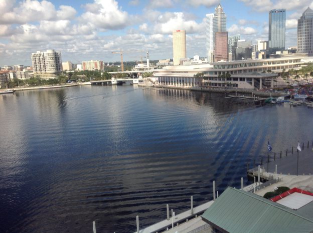
I love #friendlywaves! Victor sent me the picture above. He took it in 2017 in Tampa, Florida, and I think it’s so fascinating! There is so much going on, let’s try to make sense of it!

First, the most obvious thing making waves here: The two boats. Clearly they are making waves, and they might explain a lot of what we see here. But on the other hand, they might not.

Below, you see the part of the wave field that is 100% due to these two ships: Their V-shaped wakes (in red) and the turbulent wake behind one of the ships (in yellow).
The very prominent wave pattern (marked in red in the image below) might be due to these two ships as was suggested to me, but if it is, then those ships changed course quite drastically before they created the waves I marked in the previous picture (and I can see no evidence of such a change of course, usually a turn would leave a trace similar to this one).

If the boats, as I assume they did, came out from underneath the bridge and sailed in a more or less straight line (and that seems to be the case judging from their wakes as indicated in the picture above), there is no way they could have made waves that travel in front of their V-shaped wake. Similarly to how you can’t hear the supersonic aircraft before the supersonic boom (because the sound can’t travel faster than the speed of sound and the pressure signal thus gets formed into the Mach cone), waves can’t outrun their wake (which is like their 2D Mach cone). So I don’t believe that those waves were made by those two ships. Rather, I believe that they were made by a ship that is no longer visible in the area we are able to see.

So remember, this is the wave pattern we are trying to explain (Marked is only one wave crest, but you see that there are several parallel to the marked one):
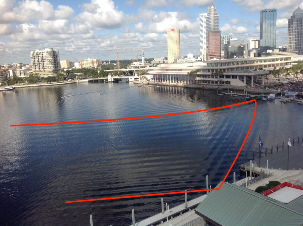
We do nicely see how the wave is reflected by the straight sea walls. But what direction is it traveling in? And what caused it? Let’s speculate!

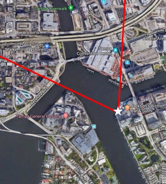
First: let’s consider the very weird shape of the body of water shown in the picture. Quick search for Tampa on Google Maps lets me believe is that the picture was taken more or less from the position of the white star and the view is the area between the two red lines. Looking at that map, we see that the water we see opens up into four different water ways: One to the north, one to the east, one to the south east, and one to the south west. The two to the south eventually open up into Tampa Bay.
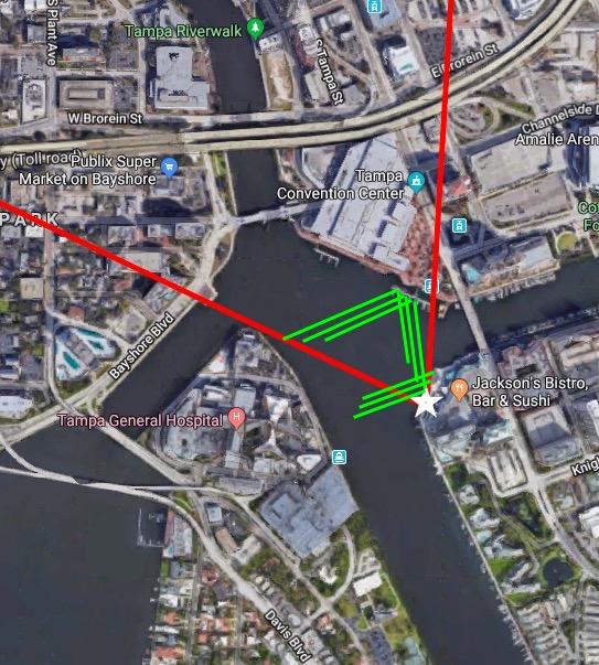
The wave field that we are trying to explain would look somewhat similar to what I drew in below (green):
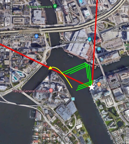
My best explanation of that green wave field above is this: A boat that went on the course that I drew in in yellow:
So far, so good. Wanna know why I believe this is what happened? Then this is the picture for you!
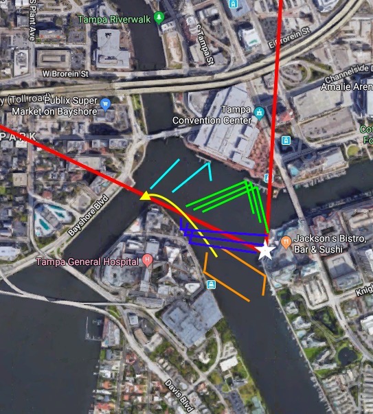
Assuming the boat followed along the yellow track, the other lines are the wake it would have produced:

  • green: Those are two parts of the wave field that I marked above that I am fairly confident of: The wake propagated across the body of water, got reflected and came then over towards the photographer. Note how not all waves reach the shoreline close to the photographer yet? That’s because they are the “newer” waves that haven’t traveled for long enough to reach that spot
  • light blue: The “newest” waves that aren’t very long yet and are traveling in an area where we can’t clearly make out the presence or absence, let alone direction, of waves. They are fanning away from the “green waves” because the ship is turning (similar to here).
  • dark blue: Those is a part from the wake that originated on the other side of the ship, got reflected, and now traveled across the body of water to reach the point where the picture was taken from. They do so at an angle that looks like they might be reflections of the incoming green waves (which is another possibility which I can’t rule out with 100% certainty). Newer wakes from that side, once they’ve been reflected on the shore, will lead to waves almost parallel to the green part of the wake and would be indistinguishable from those in the picture.
  • orange: Those are “old” wakes that must have happened when the ship came out of that inlet, but that would not interfere with our picture because their reflection stays caught within the inlet itself.

This is the best explanation of what must have happened that I can come up with, and I have thought about this quite some time (more on that at the end of this post) :-)

But then there are tons of shorter wave length waves that we have to explain, too: See those marked in red, yellow and green below.
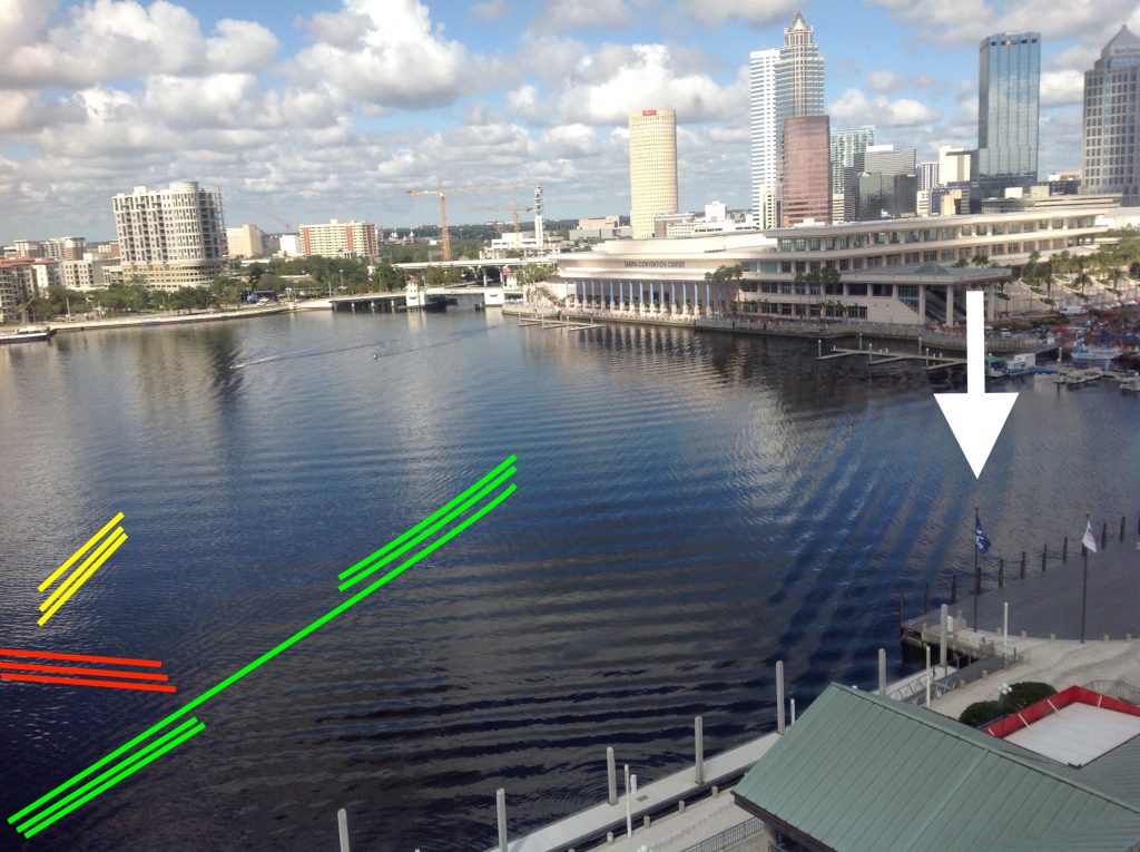
I am confident that the ones I marked in red are wind-driven waves coming across the open area. Their direction also agrees quite well with the wind directions the flags indicate (marked with a white arrow above). I believe that the ones I marked in yellow and in green are two separate wave fields at a slight angle, but that might be an optical illusion, I am not quite sure.

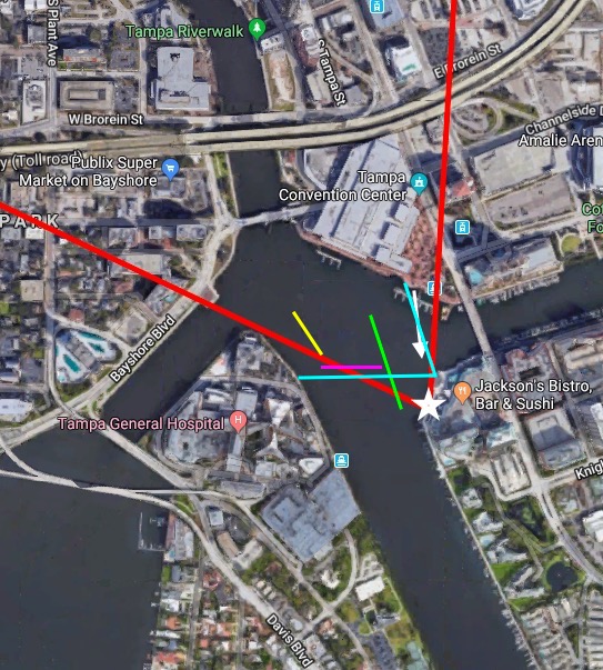
If we go back to the map, I believe the wave fields I marked above would look pretty similar to the ones I drew in below (I changed the red waves above to magenta waves below, because red was already taken. Note the wind direction marked with a white arrow: it looks pretty much perpendicular to the now-magenta wave crests):
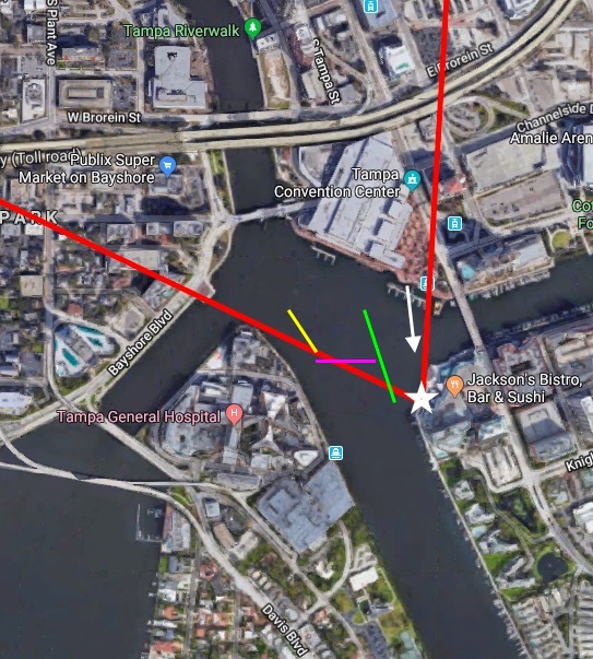
And looking at the angles in that depiction of the waves, I could imagine that the green wave field is a reflection of the magenta wave field where that one hits the shore on the side where the picture was taken from (see light blue wave crests). As for the yellow one: I still have no idea what caused that. But maybe there need to be some mysteries left to life? ;-)
To end on something that I am confident in: The half circles near the bottom of the picture are the result of something (two buoys? two small boats?) moored on that pier, bobbing up and down in the waves, thus radiating wave rings with shorter wavelengths and higher frequency than the wave that is exciting the movement.
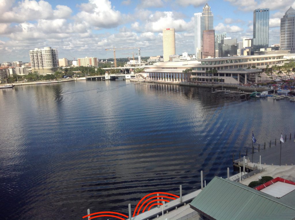
But after all this hard work (more on that at the bottom of this post) — let’s take a minute and look at those beautiful interference pattern again where the wave fields cross each other and create a checkerboard pattern. How amazing is this?
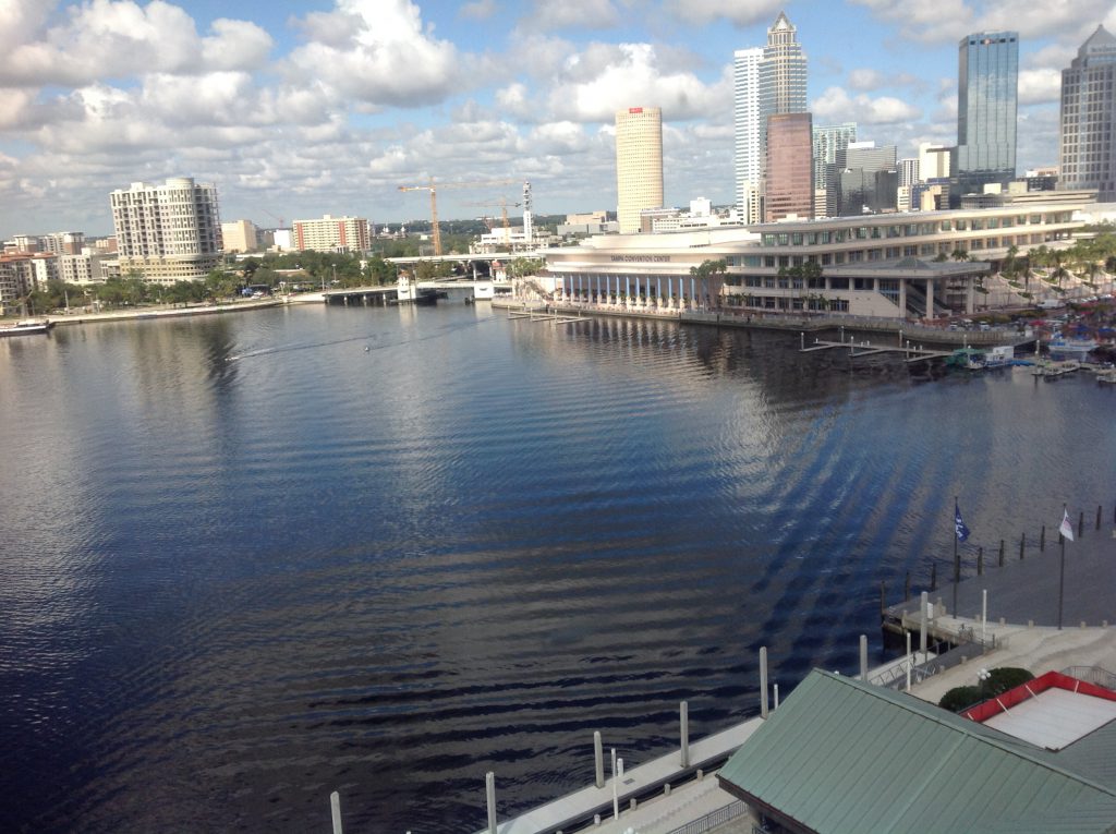
Phew! I love #friendlywaves, but this was quite a challenge! How did I do, Victor? :-)

If you or anyone else have any comments or suggestions — I would love to chat about alternative explanations!

P.S.: Just to give you an idea of what my process was like: It involved late night scribbles on a tea bag (because that was the best “paper” I had available on my bedside table in the hotel in Manchester) and I needed to play scenarios through in my head…

…and some sketches on my phone while I was on a train…
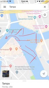
This is how much I love wave watching! :-)
Some #friendlywaves from Berlin

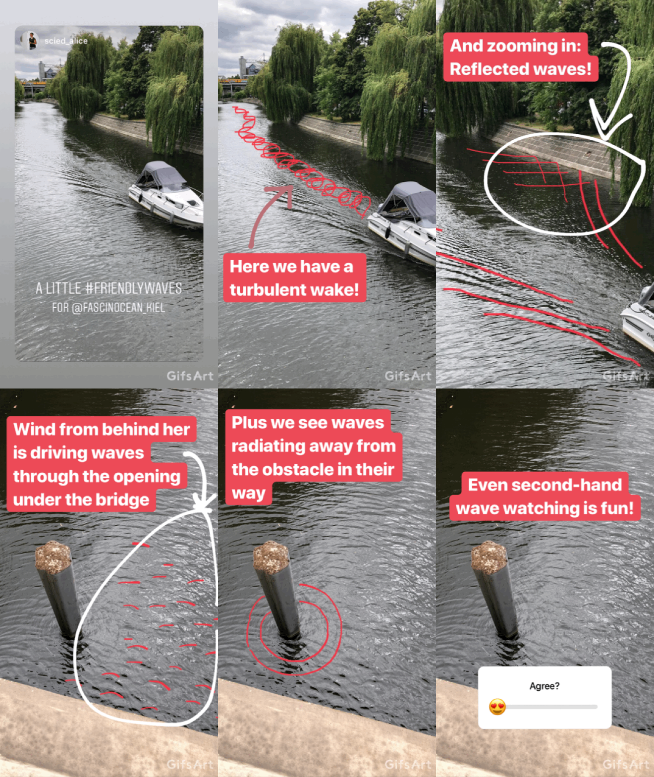
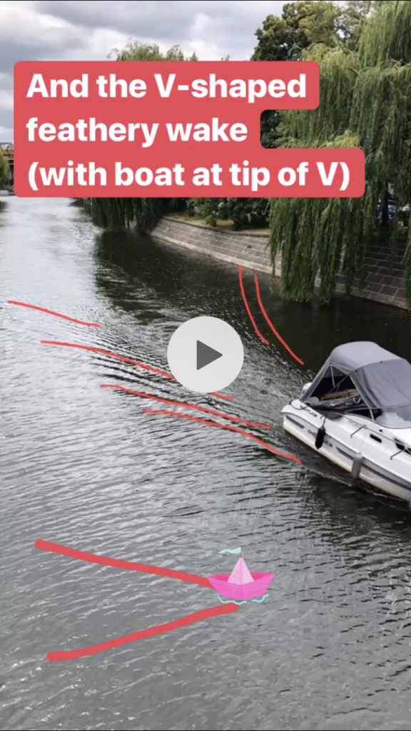
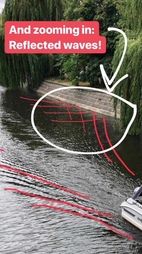
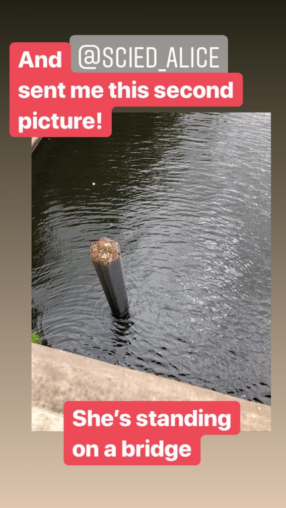
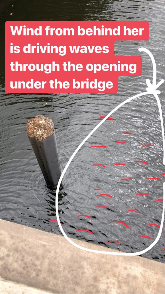
My friend Alice is currently in Berlin, and as one does when visiting Germany’s capital city: She’s wave watching!

I can only say: I approve! That’s what I always do there, too (exhibit 1, exhibit 2).

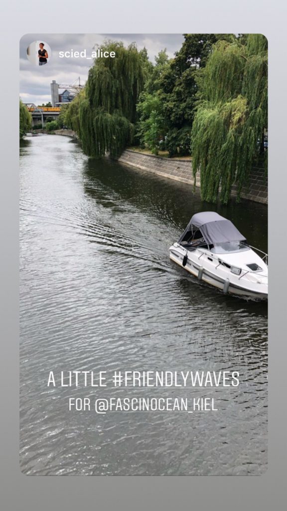
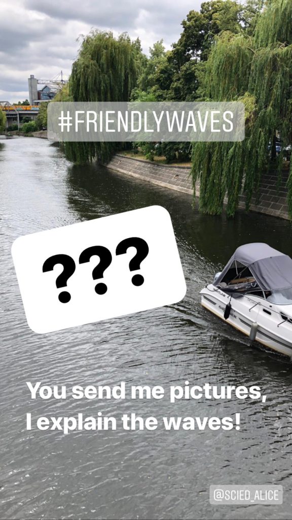
And knowing that I always like the challenge, she sent me a #friendlywaves picture. Meaning a picture of waves that she would like me to explain.

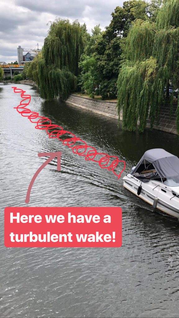
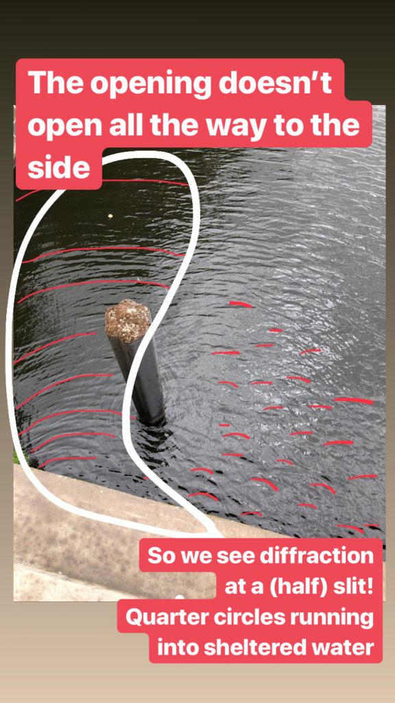
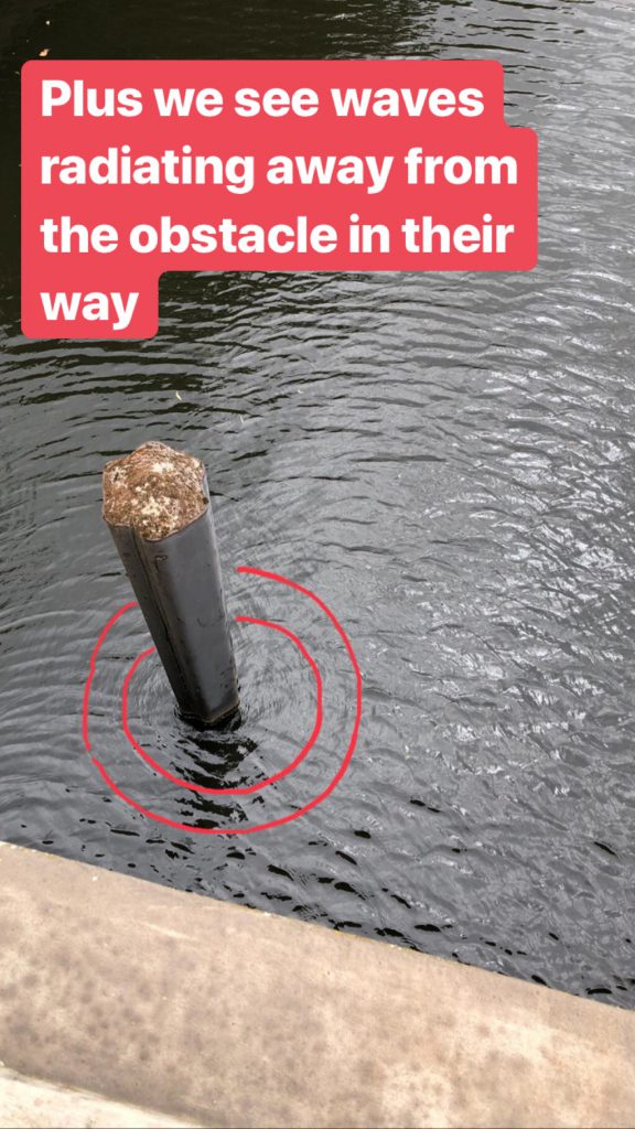
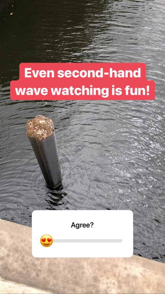
We aim to please… So here we go! (gif of the original Insta story above, individual pictures for easier viewing below)

Clearly this was done as an Instagram story and not designed to be posted on my blog, and I am not quite sure if it works. Please let me now what you think!

Nena sent me some #friendlywaves from Lago Maggiore

This is a #friendlywaves challenge, where I try to explain other people’s wave photos and they tell me how I did.

I love it when my friends see waves, think of me, whip out their cameras, take pictures, and send them to me! In this case, Nena even used a telephoto lens and took the amazing pictures below that she allowed me to share with you!

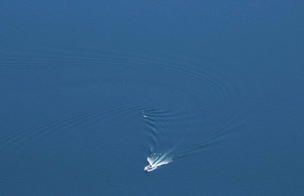
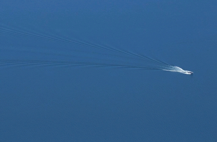
They are the perfect example for talking about wakes when a ship doesn’t just go straight ahead. Because, of cause, ships going straight ahead are the easiest case, like the one we see below.

Picture by Nena Weiler, used with permission

Here, we see the two different constituents of a wake: The turbulent wake that is the white stripe right behind the boat, that turns blue a little way behind the boat but stays a lighter color than the surrounding water.

And then there is the V-shaped wake with the boat at its tip. This V-shaped wake consists of very many individual waves that are fairly short in the direction parallel to their crests, and that are shifted slightly so the further away from the boat you look, the wider the V opens. I usually call this the “feathery” wake, since it consists of all these little “feathers”, but since I need the “feather” image for something else today, I’ll just call it the V-shaped wake here.

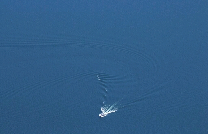
Now when the boat takes a turn, this messes up the structures of the waves making up the V-shaped wake (or makes them more interesting, depending on your point of view). Below, the boat has taken a right turn, which you can see from the turbulent wake that starts right behind the boat as a white stripe that then changes color to a lighter blue than the surrounding water (with a darker stripe to each side, and then the V further out).

Picture by Nena Weiler, used with permission

Now looking at the individual waves of the V-shaped wake, we see that they get bunched up on the right side of the boat’s trajectory, while they are getting fanned out on the left side.

Now imagine the boat’s trajectory as the shaft of a feather. If you have ever bent a feather, you will have observed that on the side the shaft is bent towards, the individual barbs (I looked this up: barbs are the little thingies that spread outwards from the feather’s shaft) get bunched together, while on the other side they fan open.

So far, so good. Still with me?

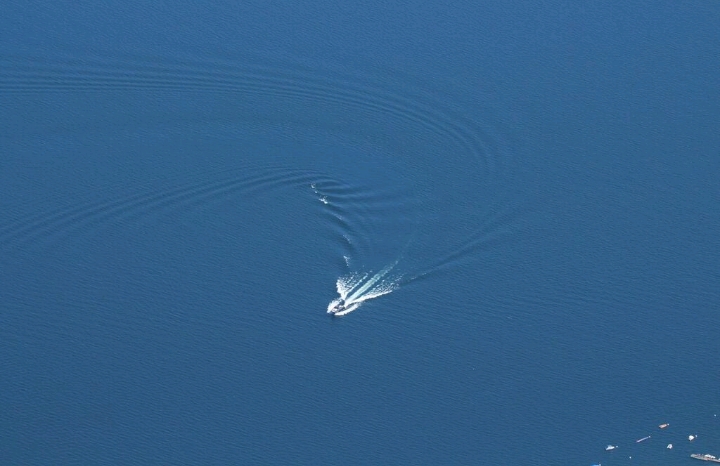
Now what happens as time goes on is that the V opens up — the two sides move away from each other. We don’t usually notice this because we are used to focussing on the wake relative to the ship rather than to some fixed vantage point. But if we looked at a fixed point while a ship going past, we’ll see the wake spreading over time until one side of the V reaches us.

Picture by Nena Weiler, used with permission

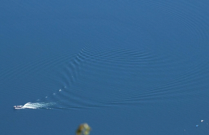
And this spreading of the V is what’s making interpretation of the picture below a little difficult. The picture below is showing almost the same part of the ocean as the one above (see the little white and blue moored boats in the bottom right corner of the lower picture? They are the same boats that are visible at the left of the bottom right corner above), only a little later. During the time between the two pictures, the ship moved further towards the bottom left corner, but also the wake spread further apart.

Above, you see that some “barbs” start running into each other (the ones where the bend is strongest, where there is foam on breaking waves because the waves suddenly become a lot steeper due to interference). So some time later, they have grown longer and are now crossing each other, which leads to the checkerboard pattern located right inside the bend of the boat’s trajectory. If you follow the V-shaped wake from the boat backwards, you can still make it out, even though it’s been deformed by the ship turning around.

Picture by Nena Weiler, used with permission

Tell me, Nena, is your family happy with this explanation? :-)

A #friendlywaves from Cyprus

My friend Alice (of the awesome Instagram @scied_alice and the equally awesome blog, which you should totally follow) sent me a #friendlywaves from her trip to Cyprus. She said that this was a simple one, so I am looking forward to what else she has up her sleeve once I pass this test ;-)

So here we go with the pictures she send.

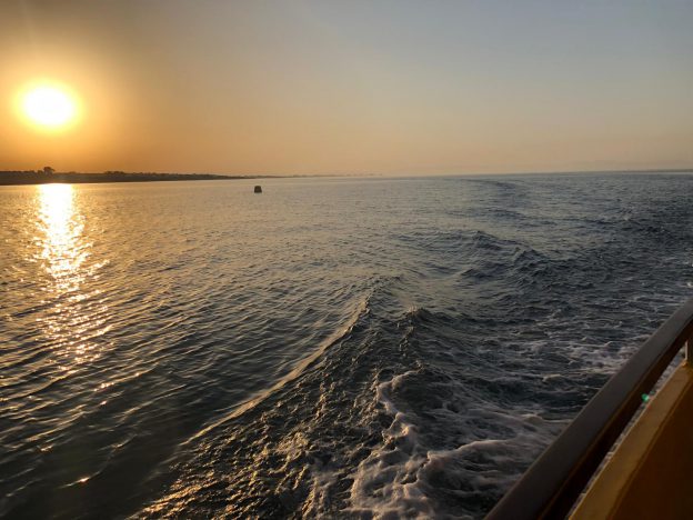
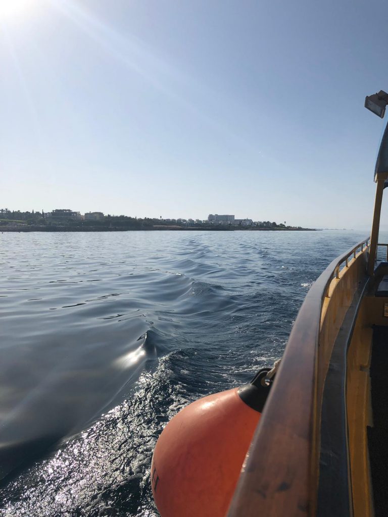
Clearly, she is on a boat trip, and she’s looking back at the wake of the ship. You see the one side of the feathery V of the wake, pretty much in the middle of the picture. On the “feather” closest to us, you can still make out the turbulent part of the breaking bow wave, where the water surface looks all crumpled up and not as smooth as it does further away from the ship. Actually, this is a really nice example to show that the waves are traveling away in the wake, but the water is not: All the other “feathers” further away have smooth surfaces as they have run away from the ship’s trajectory, while the turbulent wake traces out the exact path where the ship went (as long as there aren’t any currents moving around the water, which we’ll assume for now).

Picture by Alice Langhans, used with permission

The waves in the V-shaped wake are fairly steep, you can see them very slightly tipping over on occasion.

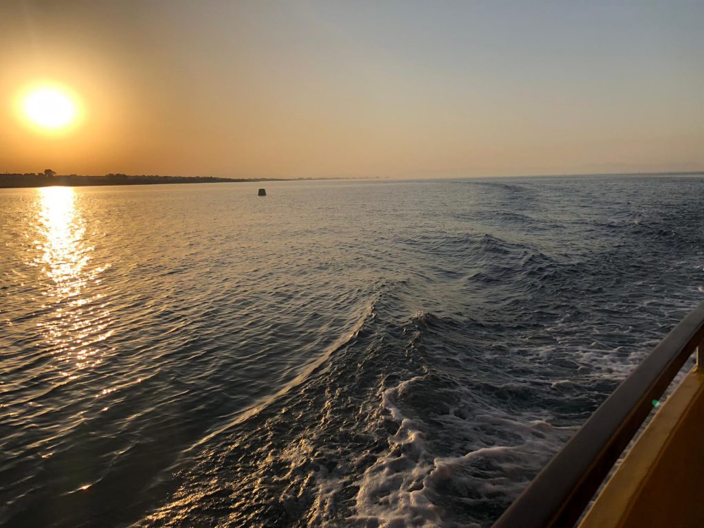
And Alice sent a second picture: Similar situation, except now it’s a little more windy. The turbulent wake is a little more foam-y than in the previous picture. This could be because the ship is sailing faster, or because it’s more windy. I would guess the first.

And when I say “sailing”, I am using this as the technical term for a ship driving. I am assuming that the boat Alice is on is not a sailboat. I’m thinking this because the wake looks fairly turbulent and sail boats usually don’t cause this much turbulence; also the little bit of the boat that I can see doesn’t really scream sailboat to me. We’ll have to wait to hear what she tells us, though!

Picture by Alice Langhans, used with permission

On both pictures, there is hardly any swell visible. Waves are usually not as visible when the water is deep as when they run up on a beach, and so far off shore we can assume that the water is fairly deep. But that also means that it isn’t very windy, hasn’t been very windy recently, and hasn’t been very windy anywhere near recently, either, so no large waves have traveled into the region.

So much for these #friendlywaves. How did I do, Alice? :-)

Hijacking other people’s “good morning!” tweets to talk about a duck’s wake

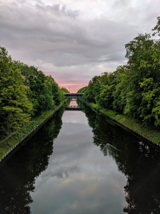
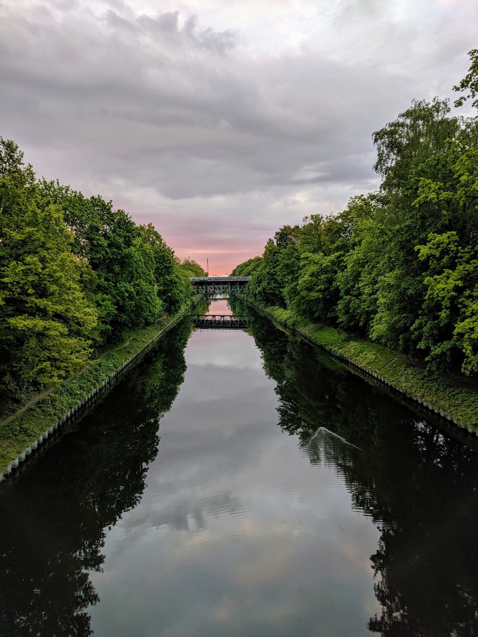
A beautiful picture: the pink sky, purple clouds, a peaceful channel flowing in between lush greens that the calm water surface mirrors back, a bridge somewhere in the background, connecting the shores, both in reality and in the image on the water. Early morning harmony. Hygge?

And what jumps at me?

Waves!

Which I think are really beautiful: Featured in the dark images of the trees on the water, a duck’s wake reflects the light sky back to us, thus becoming visible. And once we spot the V in the waves, with the almost invisible duck at its tip, we can see how the space between the feathery sides of the V is filled with half circles, connecting the feathers. They get more and more difficult to see the further away from the duck we look. The contrast becomes less clear where they aren’t set against the dark backdrop, and the more the waves dissipate with time.

This kind of waves is so common all around us, all the time. Did you ever really stop and look? It’s so worthwhile to really observe these things, to me that is happiness :-)

The Teltow channel and the bridge connecting Lankwitz and Steglitz, by Henning Krause. Picture used with permission

Reflections in waves

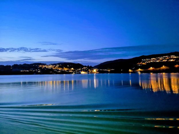
After doing a #friendlywaves post from a Norwegian fjord yesterday, let’s do another one from somewhere south of Bergen, by my friend Arnt. Very different mood today!

What I find super fascinating about the picture below is how clearly you see the ship’s feathery wake in the reflection of the street lamps on the bridge, as the ship is moving towards the left and you are looking out over it’s starboard side, more or less perpendicular to its direction of travel.

Towards the left of the picture, the street lamps reflect as straight lines towards you, as you would expect if the sea was calm and the surface more or less flat. (Why as a line rather than a single point source? Because, of course, the water isn’t completely calm, so in each wave there is an area that is positioned exactly such that the angle of the incoming light and the angle of the reflected, outgoing light (which have to always be the same) reflect the light from the lamp directly into the camera. As there are many waves that somewhere match that condition, we see light reflected in many spots even from a single lamp)

Towards the right, though, these lines of light get more and more deformed, bot as the lights get closer to us (so we notice the deformations more easily) and as there are waves caused by the ship.

Picture by Arnt Petter Både, used with permission

Picture by Arnt Petter Både, used with permission

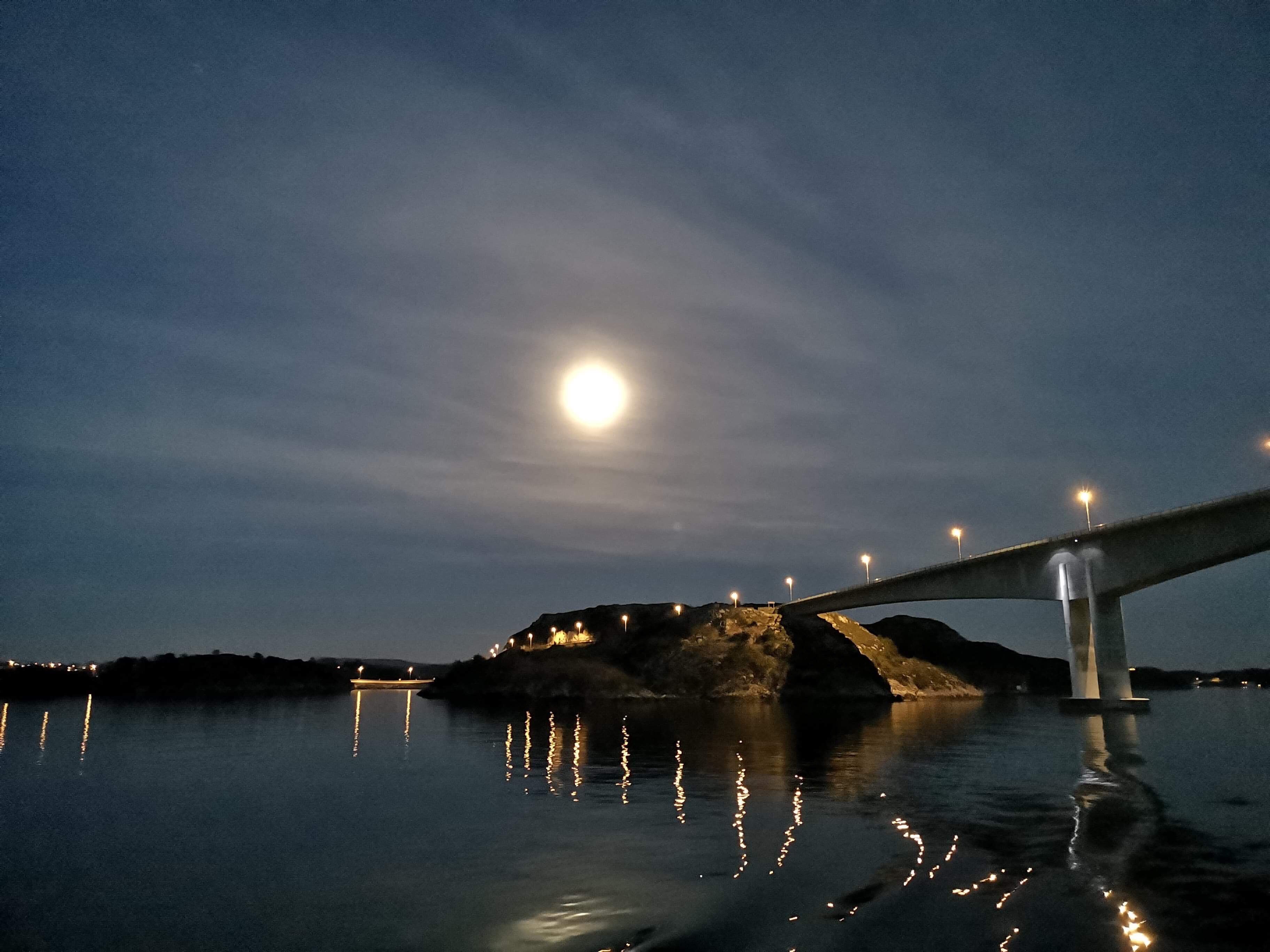
And isn’t it fascinating how the moon reflects as more of a smudge than a line? I think that is because its light is hitting the water at a steeper angle, so there would need to be much steeper waves further away if they were to reflect the light towards us.

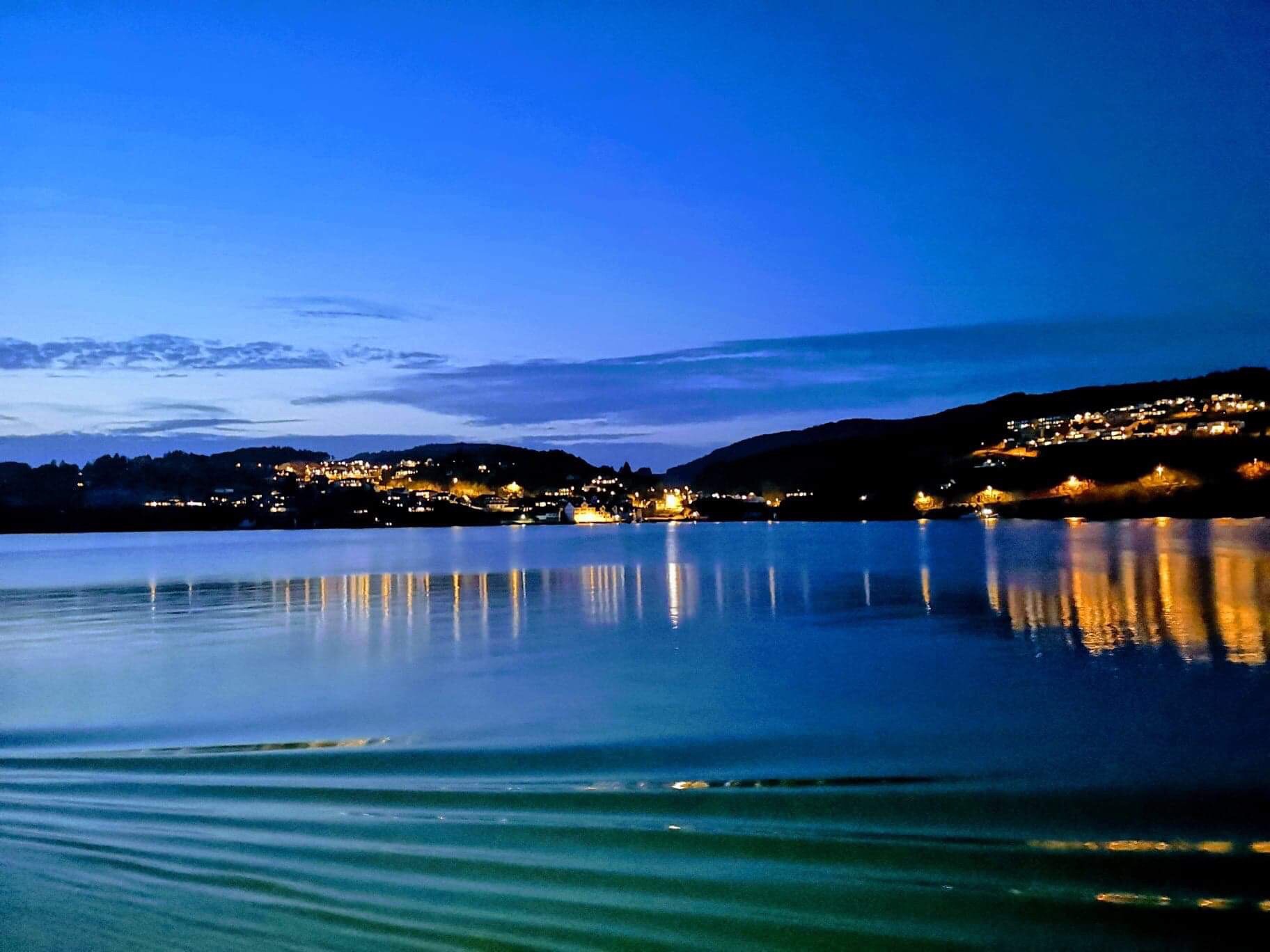
Anyway, below there is another picture from the next night, I think. Here you very clearly see the ship’s feathery wake again, and here you can see how the slope of the waves is important for what gets reflected towards us and what doesn’t: Only where we have steep slopes (i.e. only at the wake) can we see reflections f the light from the land in the lower third of the picture. There is an area where the angles clearly don’t work between that and the clear reflections further towards the shore. Oh, and do you see the different surface roughnesses that make reflections seem clearer and less clear depending on whether the surface is flatter or rougher due to a local breeze?

Picture by Arnt Petter Både, used with permission

Picture by Arnt Petter Både, used with permission

This is fun! Does anyone else have #friendlywaves for me? :-)

A #friendlywaves from a field trip in a Norwegian fjord

The other day, my friend and co-author Pierré sent me pictures he took during fieldwork in a Norwegian fjord. As I, sadly, wasn’t there, all I can do now is admire the pictures and wish I had been there. And, of course, do a #friendlywaves — an interpretation of a wave field that a friend sent me a picture of. Let’s see what he thinks about my interpretation!

So here we go. As you see, it’s a foggy day, and from the time he messaged me at, I know it was a foggy morning. The light seems to kinda be coming from a low angle which would support the morning (or evening) theory, but that’s always very hard to tell in the fog.

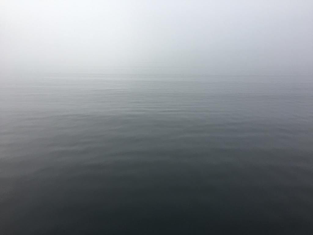
There are some waves on the sea surface, and below you see two distinct wave fields at a small angle to each other. What caused them?

I am guessing that the ones that look like sections of a circle are from some kind of point source, which would be located somewhere below and to the right of the picture’s lower right edge. Maybe something regularly dripping into the water, or a buoy being deployed. I think I’ve seen something like that when a CTD was coming up again and the wire was dripping as it went over a pulley. In any case, I am pretty sure the ship was on station as the picture was taken.

The second wave field, more or less parallel to the lower edge of the picture below, I would guess is the background field. Could be caused by anything, but nothing very close by: It’s not locally generated wind waves. If I had to guess it’s wind waves that have run for a little while. It might also be the ship gently rocking, radiating straight-ish wave fronts, but I doubt it.

As to what we can say about the spot the picture was taken in: There are no structures/shore lines really close by (otherwise we’d see reflections in the wave field), and the water depth is more than a meter or so — it’s definitely long compared to the wave length of the waves shown here as they can’t “feel” the ground (which we see from their shape — not shallow water waves).

Picture by Pierré de Wet, used with permission

The next picture, I am assuming, was sent to me to capture the mood. And to make me jealous. Yes, it worked ;-)

Picture by Pierré de Wet, used with permission

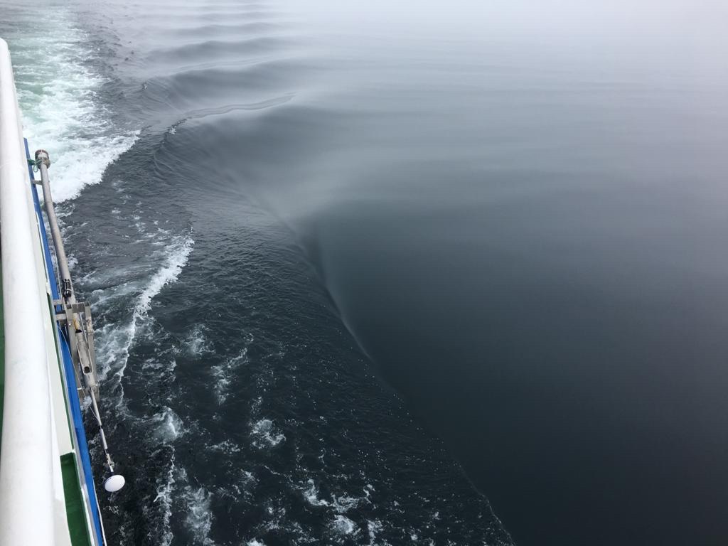
Below, we see that the ship is now moving. We are looking down and back and see the wake developing: The turbulent wake in the top left of the picture, one side of the feathery V-shaped wake on the right of the turbulent wake. The feathery waves are fairly steep, but that’s because of how they were generated, not because of any interference with the ground. The ground is still more than at least two or so wavelengths away (and it better had be, judging from the size of the ship).

There was hardly any wind when this picture was taken, the sea surface doesn’t show any locally created wind ripples.

Picture by Pierré de Wet, used with permission

I think it’s so fascinating to see the sharp line in the lower middle of the picture, separating the part of the sea surface that has been influenced by the ship from the one that hasn’t received any signal of the ship’s presence yet. If you think about the V-shaped wake as of the ship’s Mach cone, the outside of the V is where people would first hear the sonic boom after the ship has flown past!

The picture below is looking at a similar situation wake-wise. Now, though, there is a little wind: You can clearly see the enhanced surface roughness, and indeed individual capillary waves, in the bottom right corner.

Below is a third picture of the same situation. Now there are some small waves in the surface, however not locally produced, I think. Maybe they already sailed out of the spot (can you say breezy? It’s really not a windy spot) shown above?

Picture by Pierré de Wet, used with permission

What I find fascinating above is how clearly you see the one leg of the V-shaped feathery wake develop, and even in the foreground of the picture how you can see individual turbulence cells from where the bow wave broke as the ship sailed through the water.

What else do you observe? It’s not so easy to look at other people’s wave pictures and make sense of them! How did I do, Pierre?

I’m explaining your wave pictures: A #friendlywave from the Île d’Yeu, France

The whole #friendlywave thing (where I explain your wave picture) is starting off great! Here is one that reached my via my Twitter; link to thread here.

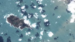
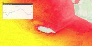
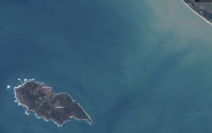
What’s going on in the north east of Île d’Yeu, France? Here are four pictures from the Twitter thread that got me intrigued: Because of the awesome waves they were displaying, but also because they introduced me to ESA’s EO browser which is so amazing that I don’t think I will be able to stop playing anytime soon!

First, a true color image of the Île d’Yeu and, more importantly, the wave field around it (Click on all pictures to enlarge).

And this is what the topography in that area looks like:

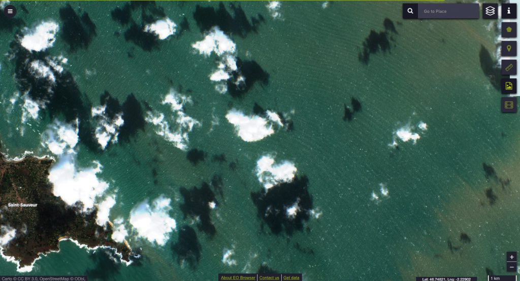
Zooming in on the area north of the eastern tip where something interesting is happening……this checkerboard pattern of waves! Now the question is what causes those waves. Well, let’s find out, shall we?

I couldn’t figure out exactly where the image above was from, but I am seeing a very similar pattern in the pictures that I saved off the EO browser myself.

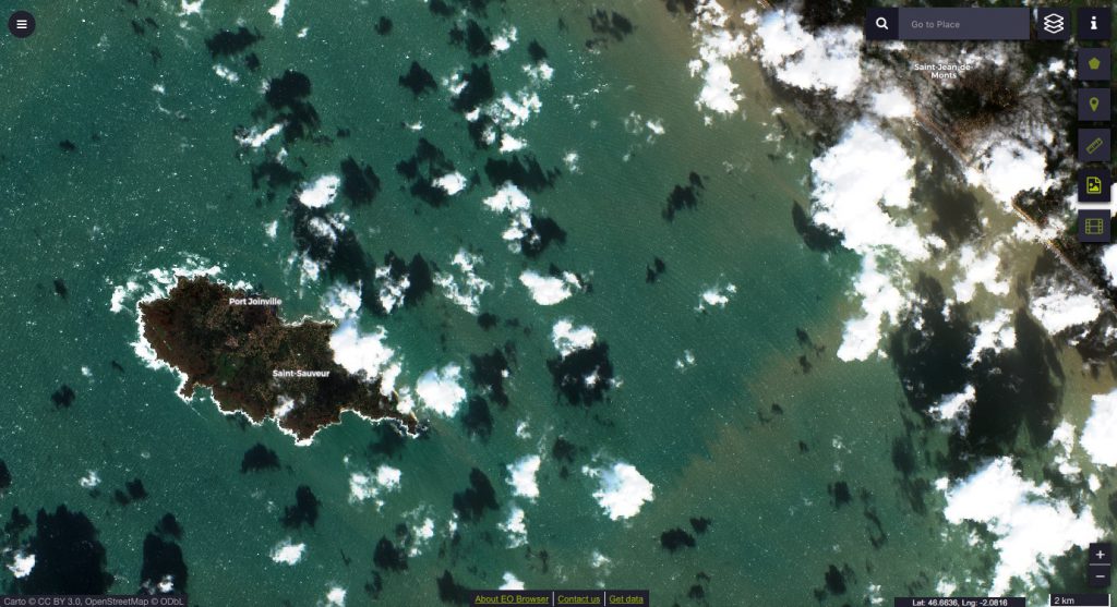
First, here is a true color image again (click to enlarge, or click the link to see it on the browser to play yourself)

True color image of Île d’Yeu and surrounding ocean, acquired with EO browser, January 28th, 2019.

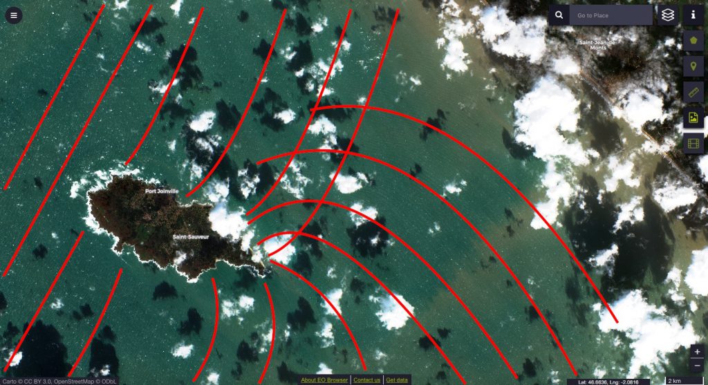
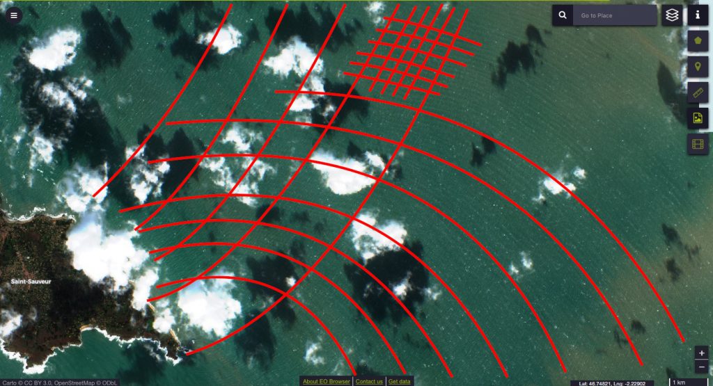
Here is the same image, except with my annotations on it. I have marked a couple of wave crests to show what I think is going on. What I see here (and please let’s discuss this! I’m super curious to hear what you think!) is a wave field coming in from west northwest-ish (see straight-ish fronts on the top left). When this wave field encounters an obstacle in its path (the island), it gets diffracted, kind of as if there were two very wide slits on either side of the island (a very simple example of that here). It’s difficult to follow the wave crests that pass the island on its north side, but the ones that go round the south side are clearly visible as they turn around the eastern tip of the island.

Zooming in to look at it more closely:

True color image of Île d’Yeu and surrounding ocean, acquired with EO browser, January 28th, 2019.

And here is my annotated version of the wave field. You recognise the wave crests that were propagating along the southern side of the island, then turned around the eastern tip and are now spreading northward. And you see the wave crests of the waves that travelled along the north coast all along. Notice how they are crossing in a crisscross pattern?The area with the really dense red checkered pattern is the one I think was shown on the original picture on Twitter. So my interpretation is that it’s an interference pattern of waves, all originating in the same wave field, being diffracted l’Île de Yeu. What do you think? Do you agree?

What I find quite interesting is that it’s very easy to follow the crests that propagate northward around the eastern tip, but a lot more difficult to do the same for the ones propagating southward. I could imagine that the explanation is the topography: The waves propagating in the north of the island were in shallower water for pretty much the length of the island, so they might have lost a lot of their energy already, whereas the ones from the south only run into shallower water once they’ve turned around the eastern tip of the island.

Thanks, Rémi, for pointing me to ESA’s awesome EO browser and to your super interesting Twitter!

P.S.: Speaking of topography: Of course the change in water depth could also have an effect on the wave field by refracting the waves towards the slower medium, i.e. the shallower water. But I don’t think that’s the case here. Do you?

Roll waves, one of the more complicated #friendlywaves I’ve gotten over the years…

#friendlywave is the new hashtag I am currently establishing. Send me your picture of waves, I will do my best to explain what’s going on there!

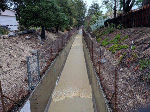
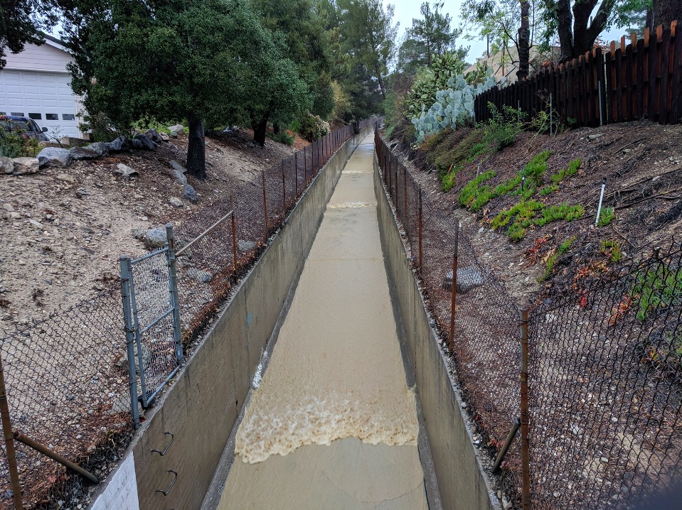
When it rains, it pours, especially in LA. So much so that they have flood control channels running throughout the city even though they are only needed a couple of days every year. But when they are needed, they should be a tourist attraction because of the awesome wave watching to be done there! As you see below, there are waves — with fronts perpendicular to the direction of flow and a jump in surface height — coming down the channel at pretty regular intervals.

Roll waves on Verdugo Wash. Photo by Mike Malaska

Even though this looks very familiar from how rain flows in gutters or even down window panes, having this #friendlywave sent to me was the first time I actually looked into these kinds of flows. Because what’s happening here is nothing like what happens in the open ocean, so many of the theories I am used to don’t actually apply here.

Looks like tidal bores traveling up a river

The waves in the picture above almost look like the tidal bores one might now from rivers like the Severn in the UK (I really want to go there bore watching some day!). Except that bores travel upstream and thus against the current, and in the picture both the flow and the waves are coming at us. But let’s look at tidal bores for a minute first anyway, because they are a good way to get into some of the concepts we’ll need later to understand roll waves, like for example the Froude number.

Froude number: Who’s faster, current or waves?

If you have a wave running up a river (as in: running against the current), there are several different scenarios, and the “Froude number” is often used to characterize them. The Froude number Fr=u/c compares how fast a current is flowing (u) with how fast a wave can propagate (c).


Side note: How do we know how fast the waves should be propagating?

The “c” that is usually used in calculating the Froude number is the phase velocity of shallow water waves c=sqrt(gH), which only depends on water depth H (and, as Mike would point out, on the gravitational constant g, which I don’t actually see as variable since I am used to working on Earth). (There is, btw, a fun experiment we did with students to learn about the phase speed of shallow water waves.) This is, however, a problem in our case since we are operating in very shallow water and the equation above assumes a sinusoidal surface, small amplitude and a lot of other stuff that is clearly not given in the see-saw waves we observe. And then this stuff quickly gets very non-linear… So using this Froude number definition is … questionable. Therefore the literature I’ve seen on the topic sometimes uses a different dispersion relation. But I like this one because it’s easy and works kinda well enough for my purposes (which is just to get a general idea of what’s going on).


Back to the Froude number.

If Fr<1 it means that the waves propagate faster than the river is flowing, so if you are standing next to the river wave watching, you will see the waves propagating upstream.

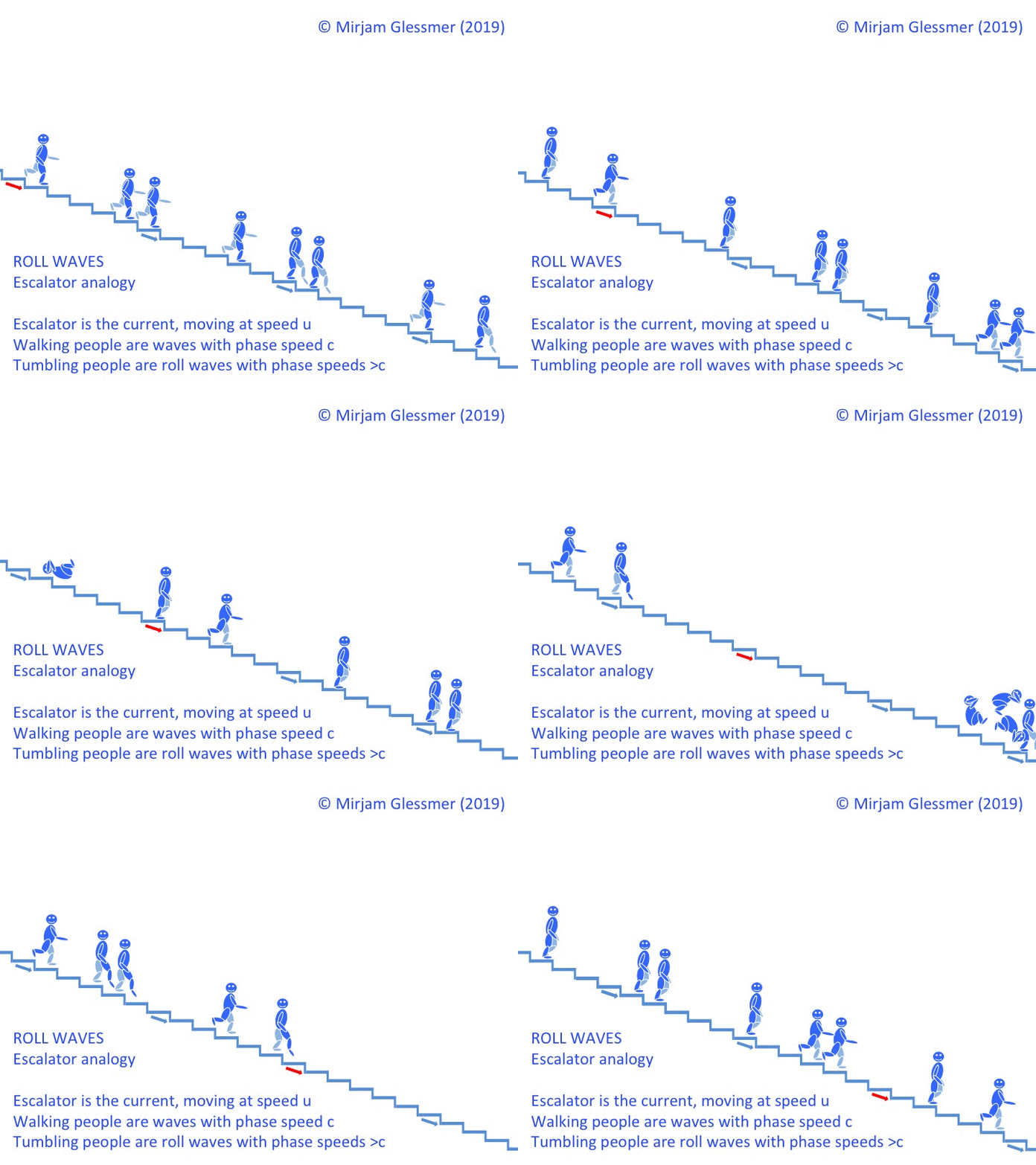
Find that hard to imagine? Imagine you are walking on an elevator, the wrong way round. The elevator is moving downward, you are trying to get upstairs anyway. But if you run faster than the elevator, you will eventually get up that way, too! This is what that looks like:

If Fr>1 however, the river is flowing faster than waves can propagate, so even though the waves are technically moving upstream when the water is used as a reference, an observer will see them moving downstream, albeit more slowly than the water itself, or a stick one might have thrown in.

On an escalator, this is what Fr>1 looks like:

But then there is a special case, in which Fr=1.

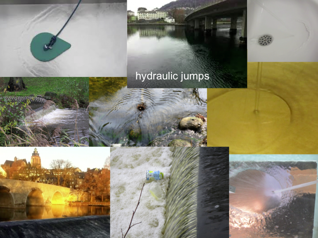
Hydraulic jumps

Fr=1 means that the current and the waves are moving at exactly the same velocity, so a wave is trapped in place. We see that a lot on weirs, for example, and there are plenty of posts on this blog where I’ve shown different examples of the so-called hydraulic jumps.

See? In all these pictures above there is one spot where the current is exactly as fast as the waves propagating against it, and in that spot the flow regime changes dramatically, and there is literally a jump in surface height, for example from shooting away from where the jet from the hose hits the bottom of the tank to flowing more slowly and in a thicker layer further out. However, all these hydraulic jumps stay in pretty much the same position over pretty long times. This is not what we observe with tidal bores.

On an escalator, you would be walking up and up and up, yet staying in place. Like so:

Roll waves

Tidal bores, and the hydraulic jumps associated with their leading edges, propagate upstream. But they are not waves the way we usually think about waves with particles moving in elliptical orbits. Instead, they are waves that are constantly breaking. And this is how they are able to move upstream: At their base, the wave is moving as fast as the river is flowing, i.e. Fr=1, so the base would stay put. As the base is constantly being pushed back downstream while running upstream at full force, the top of the wave is trying to move forward, too, moving over the base into the space where there is no base underneath it any more, hence collapsing forward. The top of the wave is able to move faster because it’s in “deeper” water and c is a function of depth. This is the breaking, the rolling of those waves. The front rolls up the rivers, entraining a lot of air, causing a lot of turbulent mixing as it is moving forward. And all in all, the whole thing looks fairly similar to what we saw in the picture above from Verdugo Wash.

But the waves are actually traveling DOWN the river

However there is a small issue that’s different. While tidal bores travel UP a river, the roll waves on Verdugo Wash actually travel DOWN. If the current and the waves are traveling in the same direction, what makes the waves break instead of just ride along on the current?

What’s tripping up these roll waves?

Any literature on the topic says that roll waves can occur for Fr>2, so any current that is twice as fast as the speed of waves at that water depth, or faster, will have those periodic surges coming downstream. But why? It doesn’t have the current pulling the base away from underneath it as it has in case of a wave traveling against the current, so what’s going on here? One thing is that roll waves occur on a slope rather than on a more or less level surface. Therefore the Froude number definitions for roll waves include the steepness of the slope — the steeper, the easier it is to trip up the waves.

Shock waves: Faster than the speed of sound

Usually shock waves are defined as disturbances that move faster than the local speed of sound in a medium, which means that it moves faster than information about its impending arrival can travel and thus there isn’t any interaction with a shock wave until it’s there and things change dramatically. This definition also works for waves traveling on the free surface of the water (rather than as a pressure wave inside the water), and describe what we see with those roll waves. Everything looks like business as usual until all of a sudden there is a jump in the surface elevation and a different flow regime surging past.

If you look at such a current (for example in the video below), you can clearly see that there are two different types of waves: The ones that behave the way you would expect (propagating with their normal wave speed [i.e. the “speed of sound”, c] while being washed downstream by the current) and then roll waves [i.e. “shock waves” with a breaking, rolling front] that surge down much faster and swallow up all the small waves in their large jump in surface elevation.

Video by Mike Malaska

In the escalator example, it would look something like this: People walking down with speed c, then someone tumbling down with speed 2c, collecting more and more people as he tumbles past. People upstream of the tumbling move more slowly (better be safe than sorry? No happy blue people were hurt in the production of the video below!).

Looking at that escalator clip, it’s also easy to imagine that wave lengths of roll waves become longer and longer the further downstream you go, because as they bump into “ordinary” waves when they are about to swallow them, they push them forward, thus extending their crest just a little more forward. And as the jump in surface height gets more pronounced over time and they collect more and more water in their crests, the bottom drag is losing more and more of its importance. Which means that the roll waves get faster and faster, the further they propagate downstream.

Speaking of bottom drag: When calculating the speed of roll waves, another variable that needs to be considered is the roughness of the ground. It’s easy to see that that would have an influence on shallow water. Explaining that is beyond this blog post, but there are examples in the videos Mike sent me, so I’ll write a blogpost on that soon.

So. This is what’s going on in LA when it is raining. Make sense so far? Great! Then we can move on to more posts on a couple of details that Mike noticed when observing the roll waves, like for example what happens to roll waves when two overflow channels run into each other and combine, or what happens when they hit an obstacle and get reflected.

Thanks for sharing your observations and getting me hooked on exploring this cool phenomenon, Mike!

Commissioned wave watching: Eckernförde edition on a beautiful calm and sunny Sunday!

Recently, more and more of my friends send me pictures of waves they spotted when walking along a lake side or taking a ferry ride. I love how contagious wave watching is, and I love sharing my fascination with you! :-)
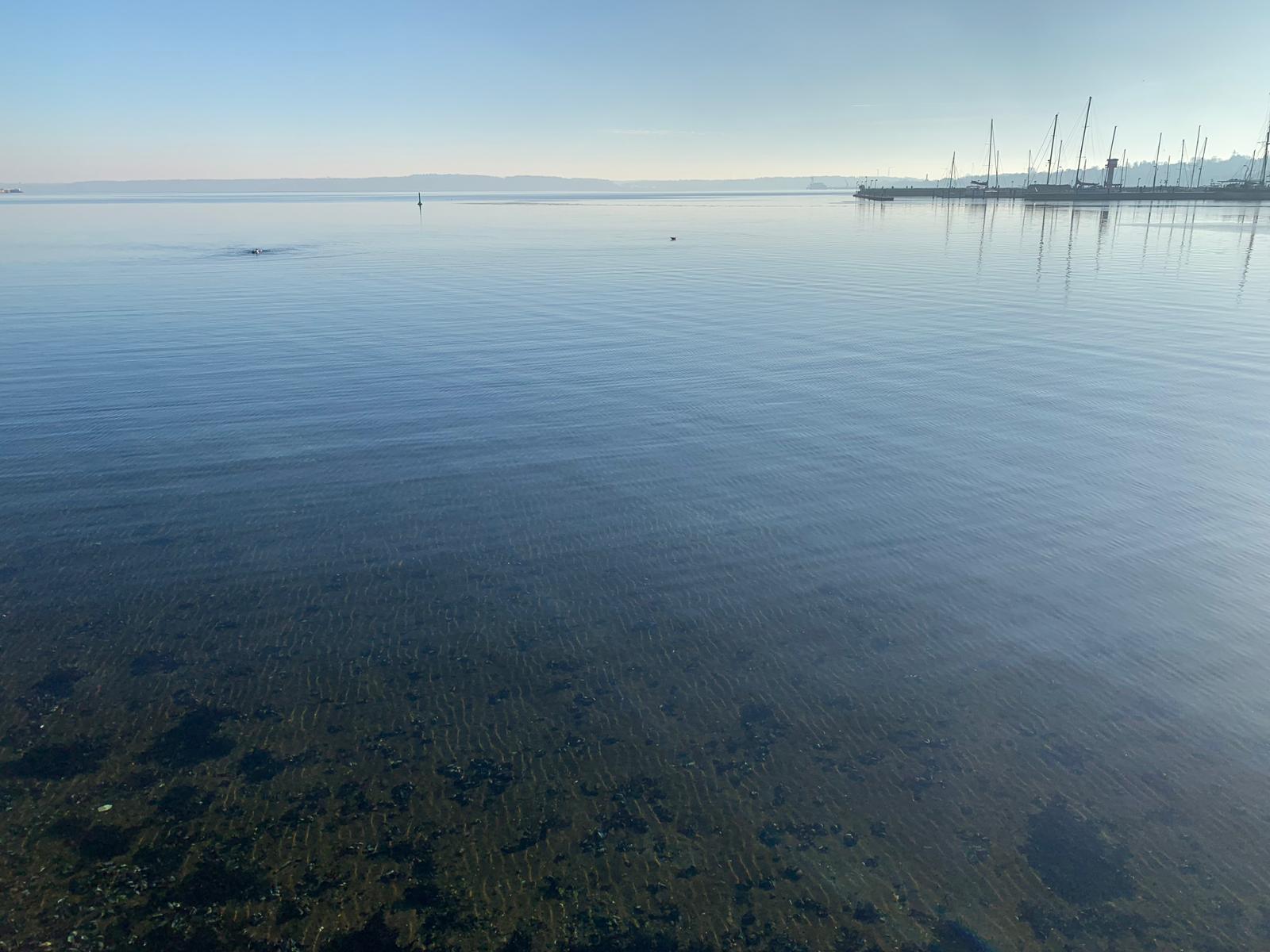
Here are some pictures that Fred sent me of his lovely Sunday walk today. There are at least five interesting things that I notice in the picture below. How about you?

  1. Look at the beautiful interference pattern where two wave fields are almost perpendicular to each other, creating the checkerboard pattern! As you see in the picture below, there is one wave field coming in at a 45ish° angle to the sea wall, so its reflection is at 90ish° to the original wave field.
  2. In the background you see the surface roughness changing and the water seeming darker where there is a breeze going over the water, creating small ripples that reflect the sky in a different way than the smooth surface closer to us.
  3. See the waves the seagull made where it landed on the water?
  4. Looking at the foreground, do you see the tiny ripples that show up not so much on the surface of the water, but rather at the sandy ground, because they focus the light?
  5. And notice how you can look into the water in the foreground but not in the background? That’s the awesome phenomenon of total internal reflection where, if you look at water at an angle that is smaller than a critical angle, you cannot look into the water any more but just see light reflected at the surface! One of the things I never understood we had to learn about in school, but that I find super cool now.

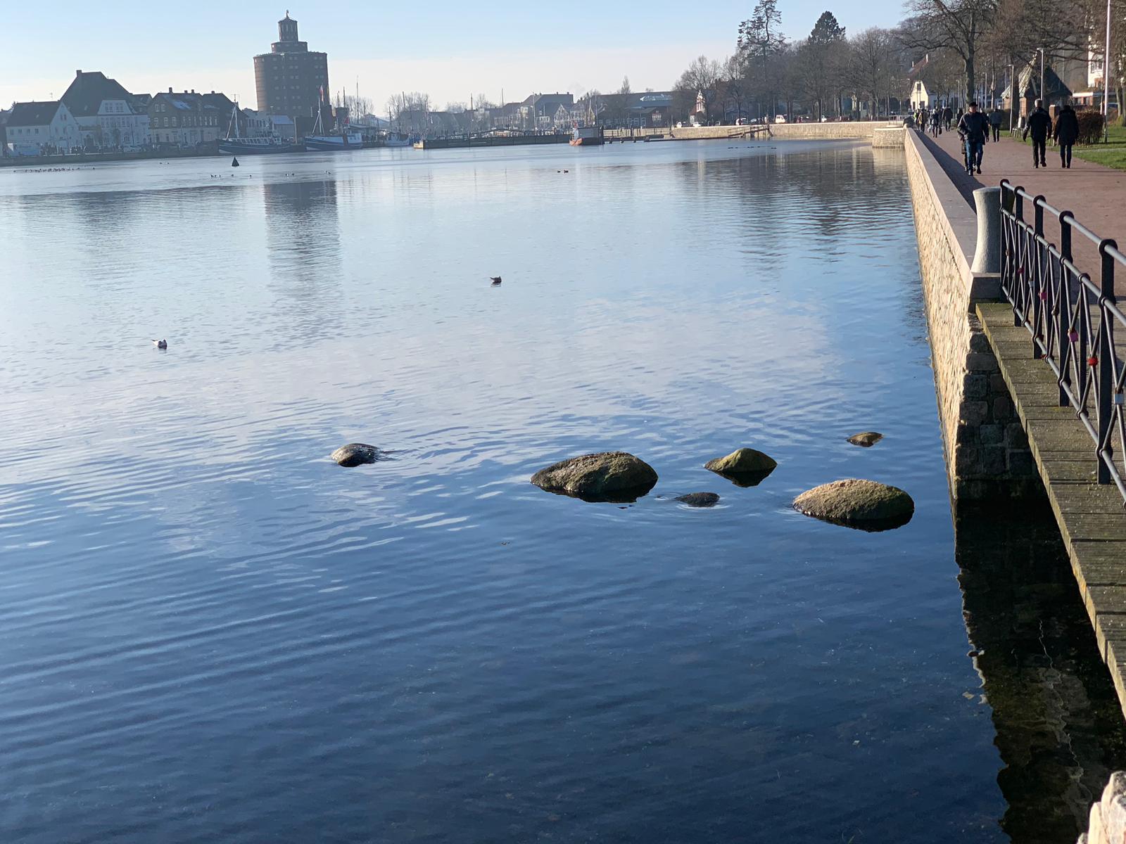
And in the picture below, what do you see?

What I find most interesting in the picture above is how the reflection of that storehouse tower looks different in areas with different surface roughnesses. Where there is a breeze on the water in the background and in the foreground, it’s a lot more spotty than in the calm and smooth surface in between. And the checkerboard waves pattern (now you see the seawall that created the reflection, btw) carries through to the reflections, too, with the blue crisscross going into the white area where a cloud is reflected.
And then the phenomenon of total internal reflection is really clearly visible here with a lot of reflections on the water (or just more interesting things to reflect than just a blue sky in the previous picture) and a view down to the ground only in the very foreground of the picture.

Thanks for sharing these beautiful pics, Fred!