#BergenWaveWatching: observing the tides from a bus
Reposted from Elin’s blog:
Kjersti, Steffi, Elin and myself (Mirjam) recently discussed ways to better integrate the GEOF105 student cruise into the course. My suggestion was to ask the students to observe things throughout the whole duration of the course, and then have them relate their time series with what they observe when “at sea”. In this mini series tagged #BergenWaveWatching, I write up a couple of suggestions I have for observations that are easy and fun to make. I am anticipating that my suggestions will be strongly biased towards #wavewatching, so if you have any other suggestions, I am all ears! :-)
My first recommendation in this series is actually more about watching tides than watching waves, but it is impressive and well worth a visit!
Where to go
Straume Bru — either get off the bus 51 at that bus stop and walk around (as I did for this blog post), or, if you have to take that bus regularly anyway, just observe from the bus.
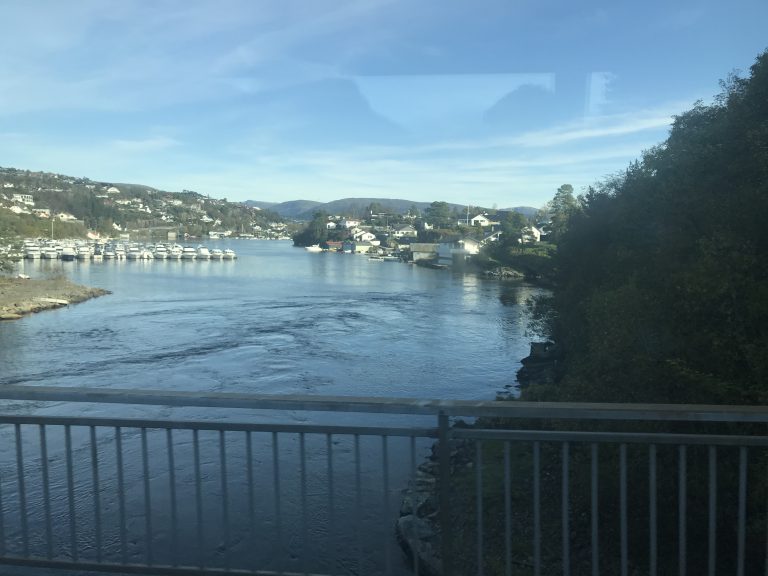
Observing the tidal current at Straume Bru from the bus
When to go
If you are going for a one-off visit, you might be well-advised to look at the tidal forecast and time your visit so you are there a little later than half time between high water and low water (or, I am assuming, low water and high water), so you will be able to observe strong tidal currents. As the currents change direction when the tide turns, there will also be periods with no current or very weak current, which are probably not nearly as impressive. Ideally I would want to spend a full tidal cycle there, but I haven’t gotten around to doing that yet. Maybe you will?
If you only pass the current on the bus, then you will hopefully do it often and take many pictures!
What to look out for
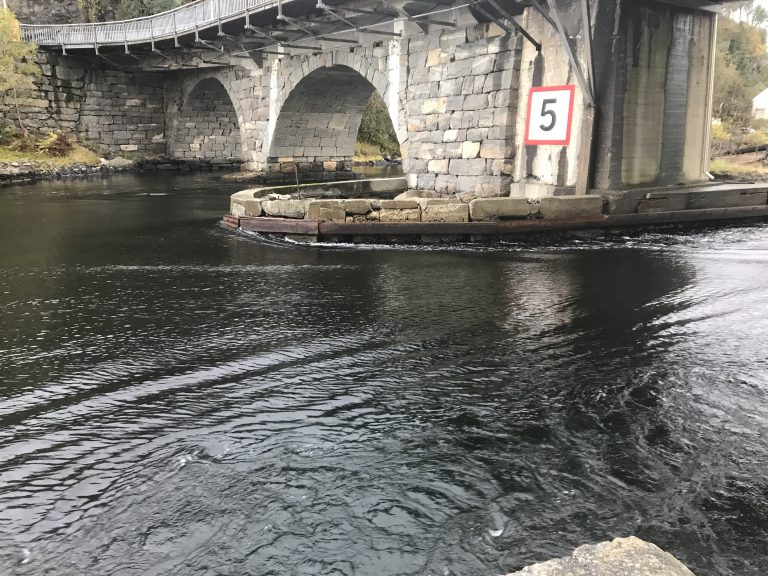
If you are at Straume Bru at the right time, you will be able to see a strong current going underneath the bridge. You might want to take pictures of the current that also include features of either the bridge or other structures or landmarks, so you can relate this and further pictures you might take to each other. What’s the water level like? How strong is the current? Which direction is it going in?
A picture of the tidal current at Straume Bru, including the bridge itself for scale and reference
What to do with the data
By “data”, I mean the collection of pictures on your smartphone. You could, for example, relate them (thanks to the phone’s time stamp on the pictures) to time before/after high water as I did in this post for tides on the Elbe river in Germany. This of course doesn’t account for the spring/neap signal, which you might want to include.
Questions that I find interesting: When is the strongest current actually happening relative to high water, and within the spring/neap cycle? In what way do ingoing and outgoing currents differ (and why? Shape of the landscape? Different gradients in the water level? …)?
How this is relevant for the student cruise
One task on the GEOF105 student cruise is relating trajectories of drifters to several factors. The wind field on that day, for example, but also the tidal currents in Byfjorden. Even though the drifters will be deployed in a different area, having a good intuitive understanding of tides makes interpreting the drifters’ trajectories a lot easier.
Do you have suggestions for us? What other spots or topics would you recommend in and around Bergen to be added to the #BergenWaveWatching list? Please leave a comment! We are always looking to expand this list!