Using real time data of ship positions in teaching?
This morning I was looking for the current position of a research vessel on MarineTraffic.com and noticed something that should maybe not have been surprising, but that I had never really thought about: How all the fishing vessels (orange) are sitting right on the shelf break! I guess that’s where they should be when we think about currents and nutrients and primary production and fish, but how cool is it to actually see it?
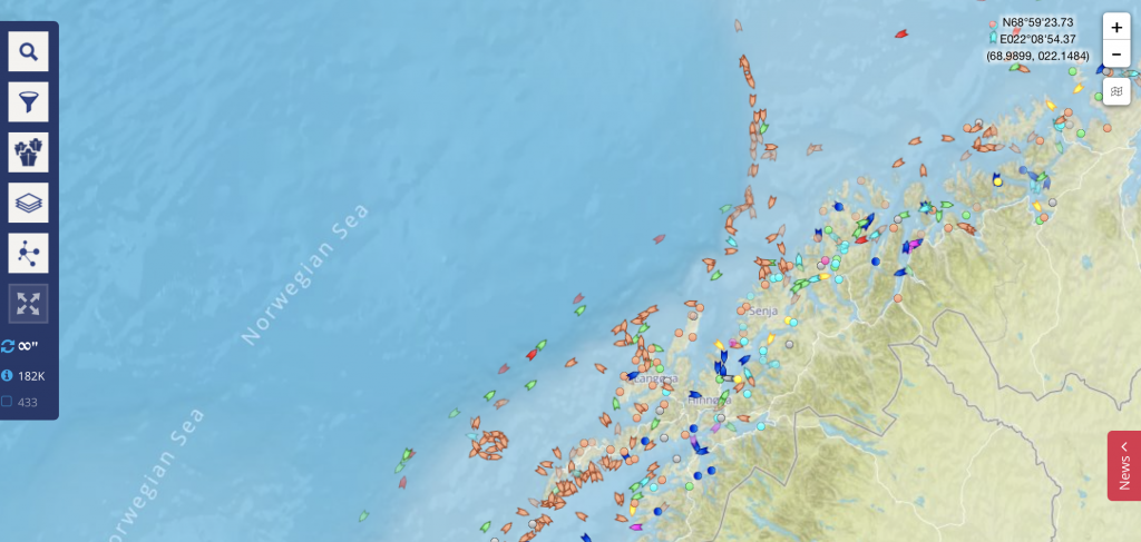
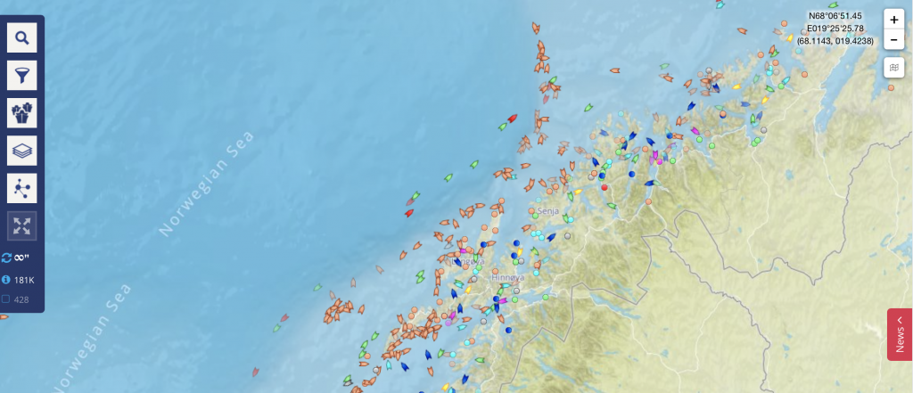
And see that area west of Lofoten where there are a lot of fishing boats in a circle? An unnamed inside source told me that that’s where cod is spawning right now, so everybody is going there to fish. Tomorrow, the cluster might be in a completely different place. And even now, some 10 hours later, it seems to have migrated a little northward? Will definitely check again tomorrow!
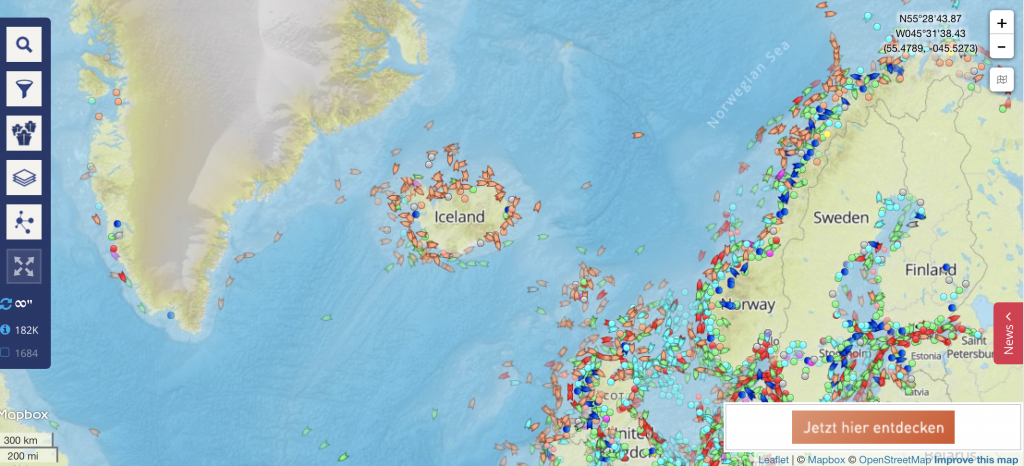
I obviously had to look whether fishing on the shelf break was just a thing in Northern Norway and turns out that it’s the same on the Greenland Shelf.
Now that I got into playing, I found it also really interesting to see that there is a lot of fishing in the equatorial Pacific going on. And how clearly you can see major traffic routes even in just the distribution of ships.
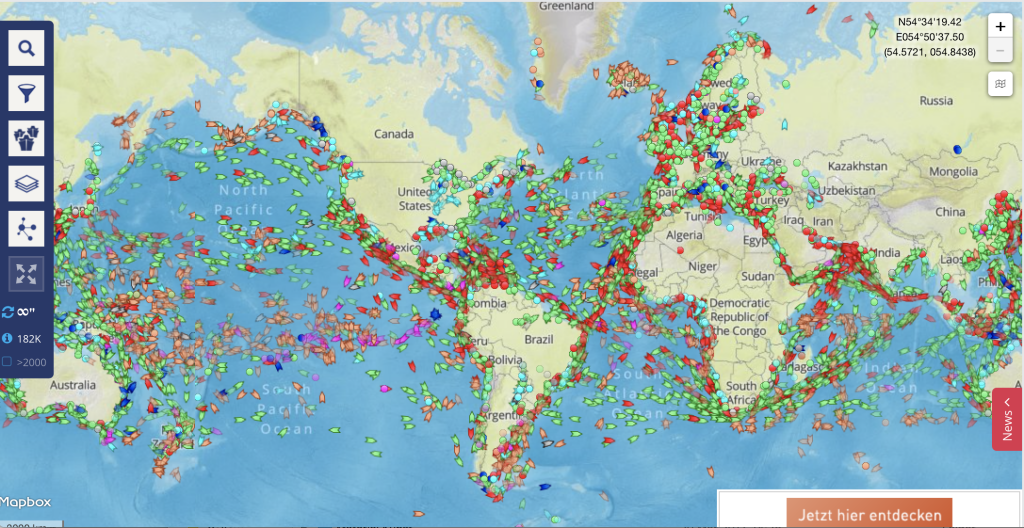
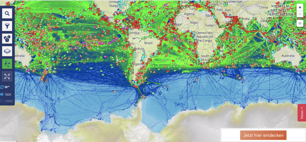
And then, ShipTracker even offers a density map of ship traffic:
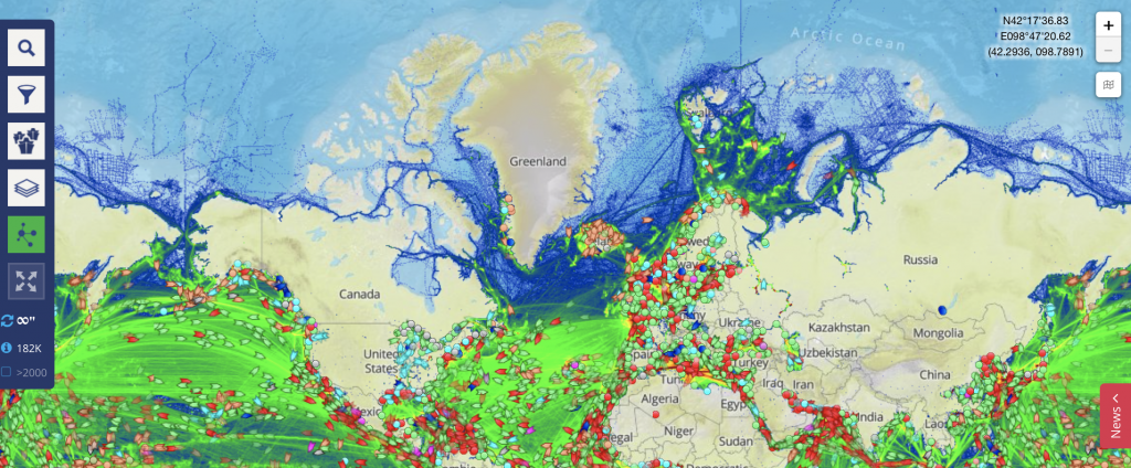
Which I had to screen-shoot in two parts because of reasons:
This site would be such a great tool for all kinds of teaching purposes. Realtime data on shipping is just a click away, even with the free version! There are so many things that students could do estimates on using this site, on transport, fishing, pollution, just pick your topic! And using authentic data makes the whole thing a lot more interesting than looking at maps or numbers a teacher would provide. Pity I’m not teaching right now!
Ships displace huge amounts of water, and it doesn’t come back immediately when they are gone! | Dr. Mirjam S. Glessmer says:
[…] amount of water. The one above is 115m long, 19m wide and has a drought of 5.4m (according to my favourite app). That means that it displaces almost 12000m3 of water! And this water has to come from somewhere […]
Wave watching at the locks in Kiel Holtenau | Mirjam S. Glessmer says:
[…] locks, which you see in the background of the picture below. And I should have checked out my favourite ship tracking app for better timing, I had to wait for quite some time before there were any ships apart from the […]
Locks at Kiel Canal | Mirjam S. Glessmer says:
[…] armed with my favourite app, VesselFinder (similar to marine traffic described here), because it let’s me anticipate which ships will come […]