Forget climate change and all the big questions, there is this one thing that is really bugging me because I haven’t figured it out yet, but I really want to: This morning, when I was searching my old backup drives for data for my friend, I came across my favorite oceanography riddle of all times (which is still, as far as I know, unsolved!).
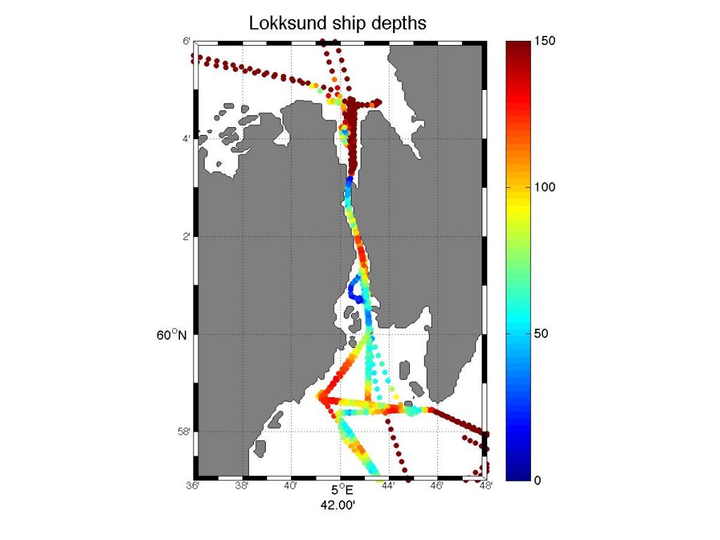
In 2012 and 2013, I went on cruises in the area of Hardangerfjorden, and there is one place that I find very intriguing: A narrow straight, connecting Hardangerfjorden in the south to Bjørnafjorden in the north. This straight is called Lokksund, and in its narrowest bit it’s only something like 20 meters wide and 30 meters deep. Which, as soon as water levels on both ends of the street are not exactly the same, leads to pretty strong currents.
In the description of Norwegian shipping lanes, it says about Lokksund “in the narrow part of the straight, the tidal current can be strong, up to 3-4 knots during spring tides, shifting direction every two hours. It goes southward for two hours before high tide, stops at high tide, goes north for two hours after high tide, and so on. … If there is constant wind from the south, the current can go continuously northwards. For wind from north or west, the same situation can happen with southward currents” (Den norske los 3, Farvannsbeskrivelse, Jørem Rev-Stad, 2006).
That the current is very strong in the straight was fairly obvious, and captain and crew were understandably not too happy that we wanted to spend a lot of time there (funnily enough, it’s Lokksund you see on the map on the screen in the picture below! Clearly, I really wanted to go there!).
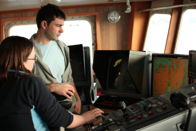
On the bridge, discussing the scientific plan for the next day. Picture courtesy of Angus Munro.
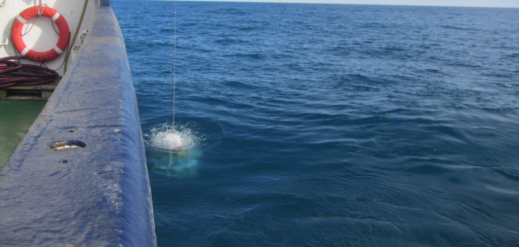
However, the current directions that we observed didn’t seem to agree with the farvannsbeskrivelse, but they also did not seem to agree with tides from mooring data we had from north and south of the mouths of Lokksund. So we ended up doing a repeat CTD station just north of Lokksund. The CTD data is very interesting:
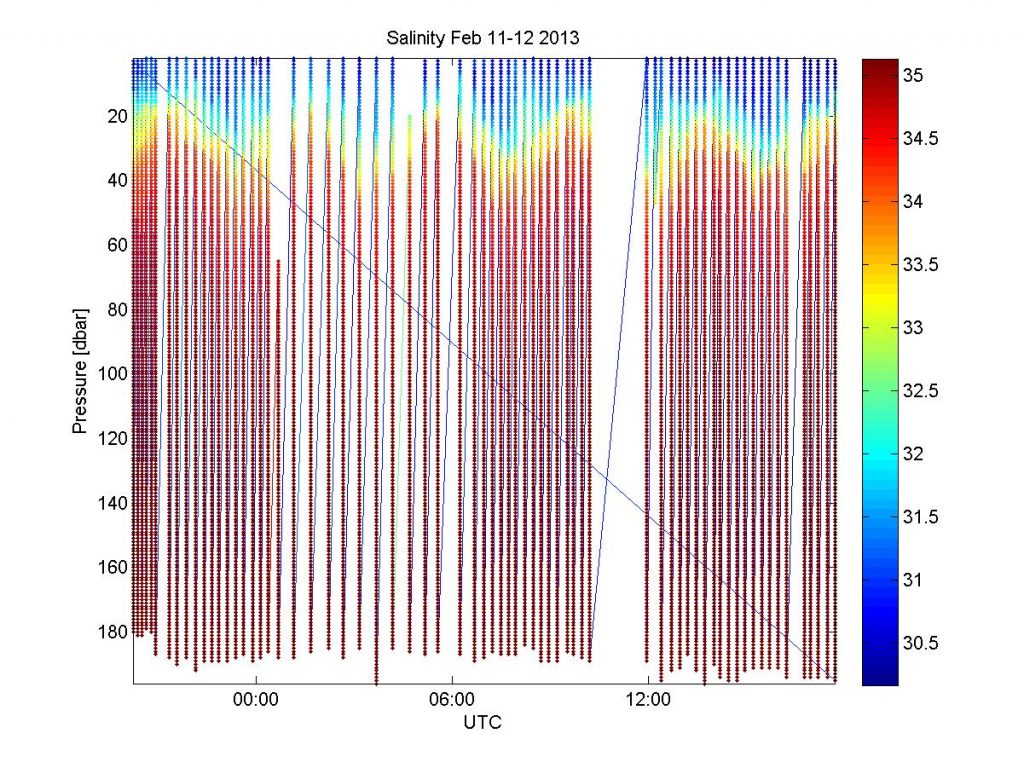
Above, you see a plot for salinity, and below for temperature. And there is a strong interface in both S and T — approximately at sill depth! — that is oscillating with the same frequency as described in the farvannsbeskrivelse, although from what I remember the timing was somehow different from what we expected based on the tides from the mooring data we had available.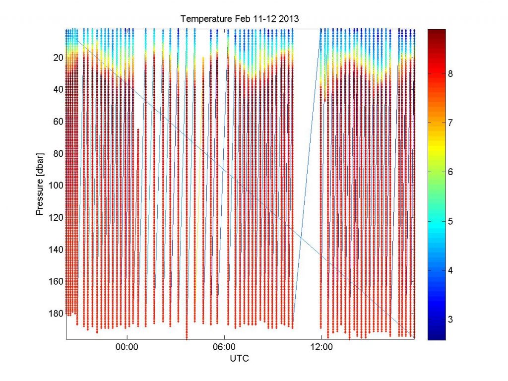
Also, looking at how narrow the straight is, even with peak speeds of 3-4 knots, the volume of water that can actually go through Lokksund is actually very small. So even though the mixing in the narrow spots with high speeds is probably very high, the volume of displaced water is still very very low, and it’s not even clear how big its influence on mixing between the two fjords is.
But that’s not what makes me so intrigued: It should be such an easy system to understand: A narrow straight and water levels on either end driving the flow through the straight. Right? Except there is clearly more to it, and I wish I could go back there and figure out what that is!
I know for a fact that to this day, some of the crew vividly remember the time we spent in Lokksund during that cruise, and that they don’t have the fondest memories of being in a narrow straight in a strong current in the dark. But I still think it was good we spent all that time there, and luckily Elin is taking on this riddle now, hope you will keep us posted on what you find! :-)
I’ll bring students to Bjørnafjorden and Lokksund in February and March – let’s see what we find out!
Pingback: To the Bjørnafjord with students from GFI! – Elin Darelius & team's scientific adventures
Pingback: To the Bjørnafjord with students from GFI! – Elin Darelius & Team